Quick Info
| Length | 21 miles |
| Class (I-VI) | II-III |
| Minimum Flow | 200 cfs |
| Ideal Flow | 300 – 2,000 cfs |
| Maximum Flow | 5,000 cfs |
| Current River Conditions | USGS below Presidio |
| Put-in map | Lajitas |
| Take-out map | Santa Elena (1 mile below Terlingua Creek) |
| Boats | Canoes, Kayaks, Rafts |
| Season | Year-round, weather/flow permitting |
| Highlight | Scenic canyons, Rockslide in the canyon, great camping, hiking |
| Distance to Lajitas | Dallas 600 miles; Houston 650 miles; Austin 500 miles; El Paso 325 miles |
Recreation & Access
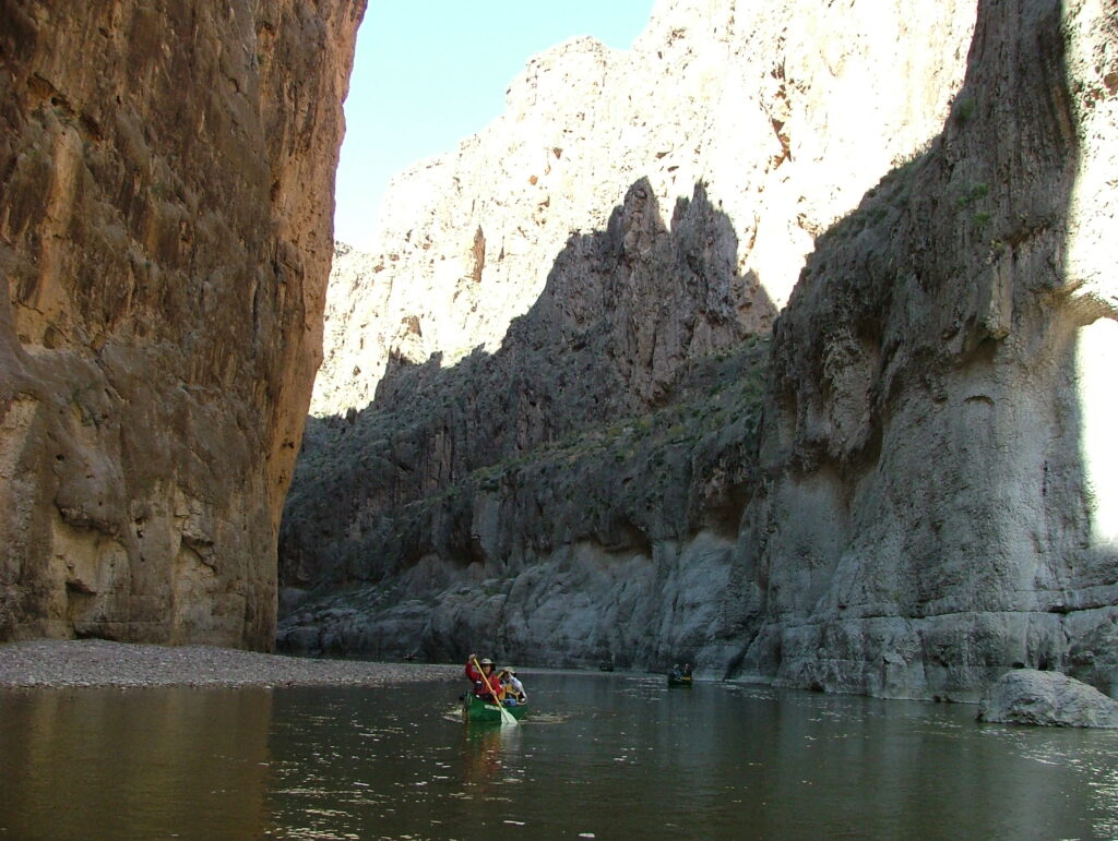
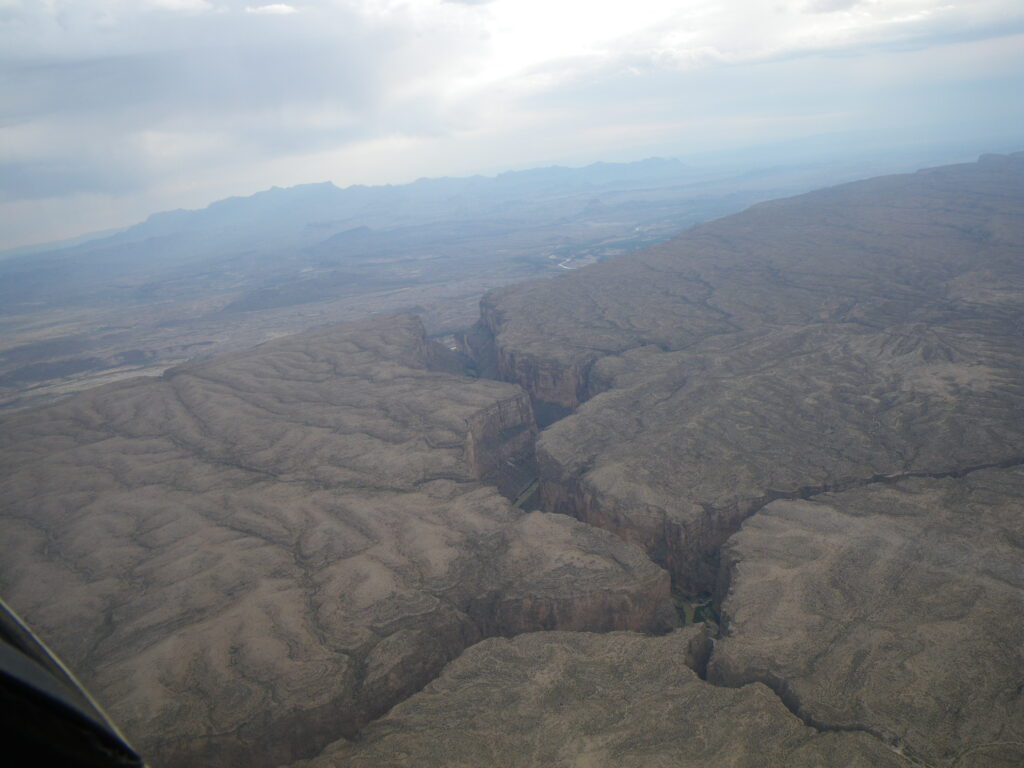
Easy access and parking at Lajitas. This section provides fun whitewater with many pool and drop rapids and rock gardens. Beware of river cane along the banks that can take you out of your boat. Good campsites and hiking at San Miguel Creek (right), Entrance Camp (left) and several campsites within the canyon make this section a great overnight trip. A Boomerang trip from the mouth of the canyon at Terlingua Creek, upstream into Santa Elena Canyon and back is often the only practical choice for paddling in the park when river levels are very low. It’s a great day trip.
Conservation & Threats
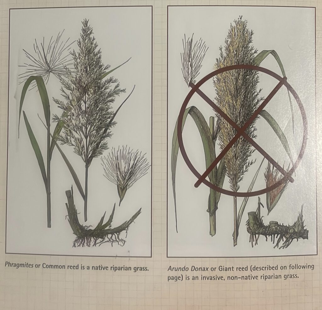
Bacterial infections are easy to contract. Use soap and clean water, especially with open sores on hands or feet. Development encroachment, water pollution. Invasive Giant reed (Arundo donax) and salt cedar (Tamarix) are ubiquitous along the river banks.
Historical/Cultural Significance
Conflict with Mexico continued when the United States annexed Texas as a state in 1845. Mexico claimed that the new border between Texas and Mexico was the Nueces River, while the United States contested the border was the Rio Grande. The Treaty of Guadalupe Hidalgo, that brought an official end to the Mexican-American War (1846-1848), was signed on February 2, 1848, at Guadalupe Hidalgo, where the Mexican government had fled with the advance of U.S. forces. By its terms, Mexico ceded 55 percent of its territory, including parts of present-day Arizona, California, New Mexico, Texas, Colorado, Nevada, and Utah, to the United States. Mexico relinquished all claims to Texas, and recognized the Rio Grande as the southern boundary with the United States. The United States paid Mexico $15,000,000 “in consideration of the extension acquired by the boundaries of the United States” (see Article XII of the treaty) and agreed to pay American citizens debts owed to them by the Mexican government. The treaty gave rise to development of the IBWC International Boundary and Water Commission which governs all concerns of flow and sharing of the boundary waters of the Rio Grande and other boundary waters of New Mexico, Arizona and California.
Natural Features
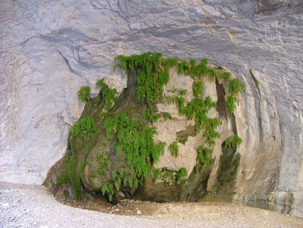
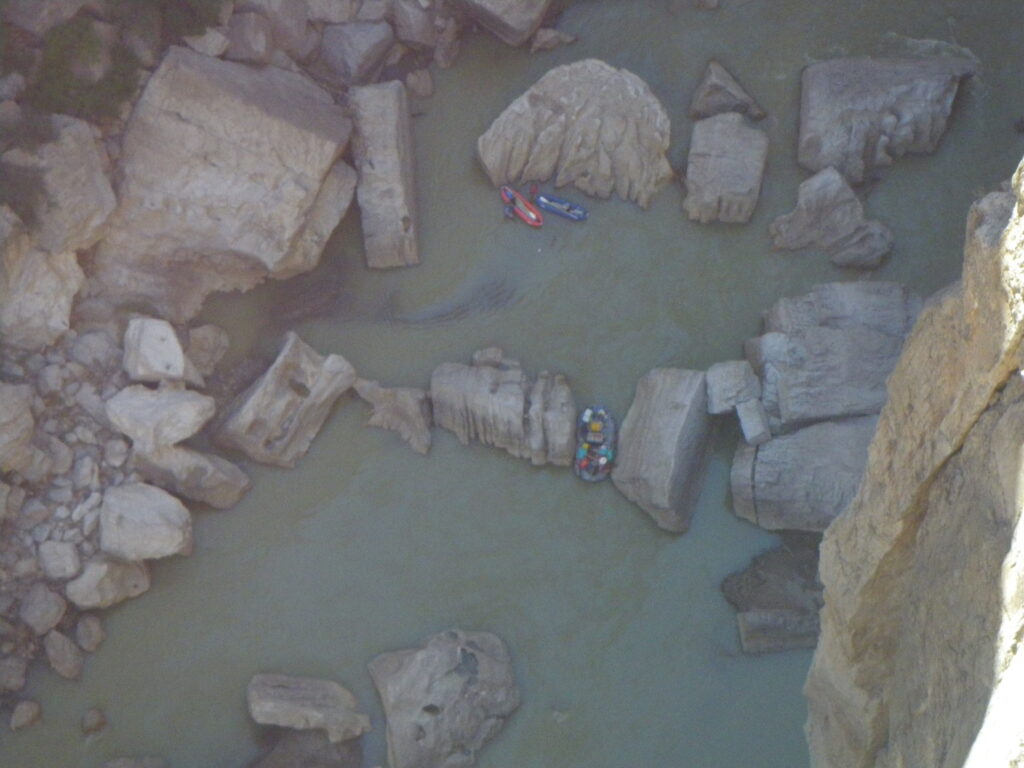
The Rockslide is the obstacle in the canyon. At normal levels, it is more a maze than a rapid. Although intimidating the first time, once you have run it and memorized the route, it is not intimidating. Fern Canyon on river right is a great lunch, hike and campsite.
Additional Resources
- Big Bend National Park, TX 79834 / (432) 477-2251
- Chart – RGWS River Mileages Presidio to Langtry 318 Miles.PDF
- NPS: Big Bend Home Page
- NPS: Big Bend Daily Report
- NPS: Floating the Rio Grande NPS Page
- Far Flung Outdoor Center, Terlingua
- Desert Sports, Terlingua
- Big Bend River Tours, Terlingua
- Angell Expeditions
- The Upper Canyons of the Rio Grande, Louis Aulbach
- Death In Big Bend, Real stories of death and rescue by Laurence Parent
Flows
- IBWC Rio Grande Gages
- IBWC Near Real Time Reports (PDF)
- USGS Gage nr Castolon
- Mexican Reservoir Storage (Rio Concho)