Overview
The San Marcos River begins at the bottom of historic Spring Lake on the campus of Texas State University and Meadows Center for Water & the Environment. Average flow at the headwaters (once known as the Aquarena Springs or Spring Lake) is 130 cubic feet per second and flows at a constant temperature of 72oF. Issuing forth from the Edwards Aquifer, the San Marcos is one of the largest volume spring-fed rivers in Texas. The San Marcos flows for 81.26 miles through Hays, Guadalupe and Caldwell Counties to the confluence with the Guadalupe River in Gonzales County. The Edwards Aquifer itself is a unique groundwater system and one of the most prolific artesian springs in the world. It serves the diverse agricultural, industrial, recreational, and residential needs of over two million users in central Texas, including San Antonio with a population nearing 1.5 million.
Recreation and Access
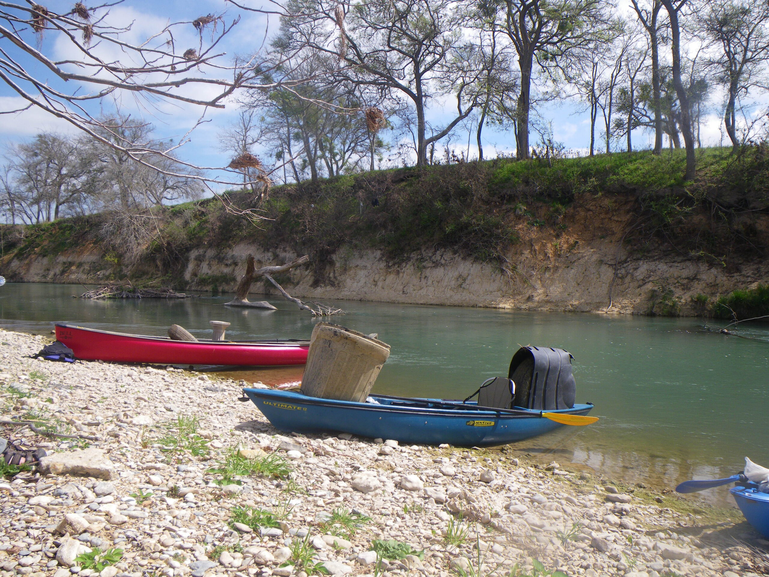
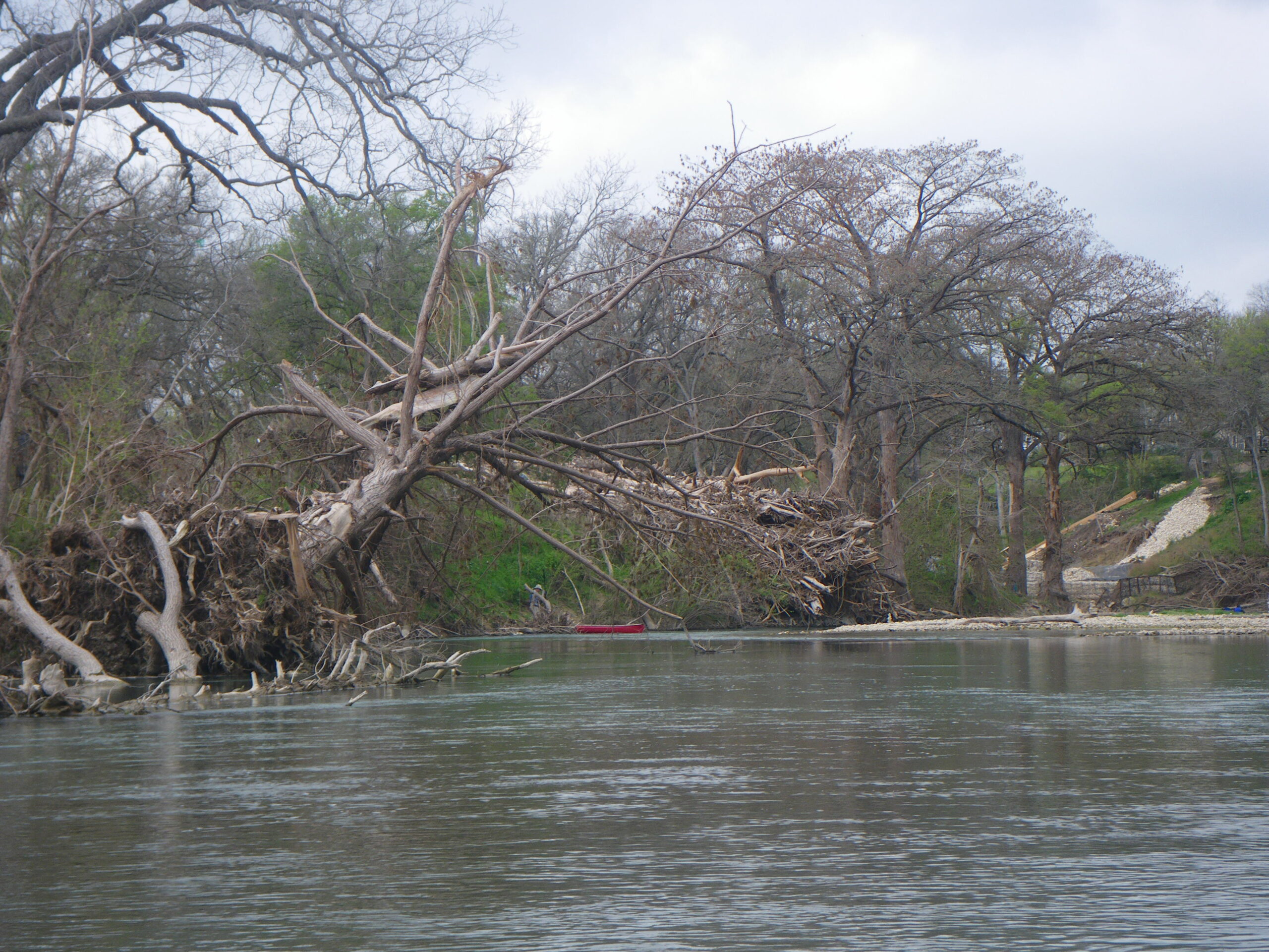
The San Marcos River is a favorite place for Texans to paddle because it is fun to paddle for all experience levels, year around. Often, when Hill Country rivers are too low to paddle, the San Marcos provides good flows for paddling.There are numerous access points for put-ins and take-outs, making San Marcos River trips more accessible than many other Texas rivers. Most recreational use of the river is limited to the upper 16.5 miles between City Park in San Marcos to FM 1977 bridge, above Staples Dam. Experienced paddlers can and do paddle the entire San Marcos to the confluence with the Guadalupe and beyond. Strategically, the river is noted for many small dams, most requiring safe portage. These dams can be dangerous and are always to be respected. While the river is generally shallow it becomes deep in front of most dams. After running past City Park, almost all property adjacent to the river is privately owned. DO NOT TRESPASS. Leave No Trace.
The availability of public parking is very limited at crossings and in the lots near Rio Vista Falls. Obey traffic signs. Please be considerate of others when accessing the river, and always park your vehicles where they do not block river access for others. Do not park or enter private property without securing permission from landowners. River gauge readings can be confusing, especially when paddling past the Blanco confluence. Beware of current weather and flash flooding upstream and on the Blanco.
The Texas Water Safari starts at Spring Lake on the second Saturday in June. Known as the World’s Toughest Canoe Race, the 260-mile race under 100 hours ends at the mouth of the Guadalupe River at Seadrift on the Gulf Coast. Bucket list.
About river gauges and levels on the San Marcos, by Tom Goynes
Featured Runs
Canoe / Kayak / SUP
Descriptions and Paddling Trails
- Rio Vista Falls to Spring Lake Dam and Return [1.2 miles, 1 hour round trip]
- City Park to Westerfield Crossing – Scout Camp [4.8-6.0 miles, 3-6 hours]
- Video: San Marcos River Retreat to Scull’s Crossing [3 miles, 2 hours, 163 cfs]
- Video: San Marcos River Retreat to Shady Grove Campground [6 miles, 3 hours]
- Luling Zedler Mill Paddling Trail [6.1 miles, 3 hours]
Launch Site Maps
San Marcos River Retreat (Scout Camp) to Staples [11 miles, 6 hours]
San Marcos River Retreat (Scout Camp) to Sculls Crossing [3 miles, 2 hours]
Sculls Crossing to Shady Grove Campground / Spencer’s [1.8 miles]
Shady Grove Campground to Staples [5 miles, 3 hours]
Tube Trips
- City Park to Rio Vista Dam [1 mile, 1 hour]
- County Rd. 101 to San Marcos River Retreat [1 mile, 1 hour]
- Leave No Trace
Natural Features
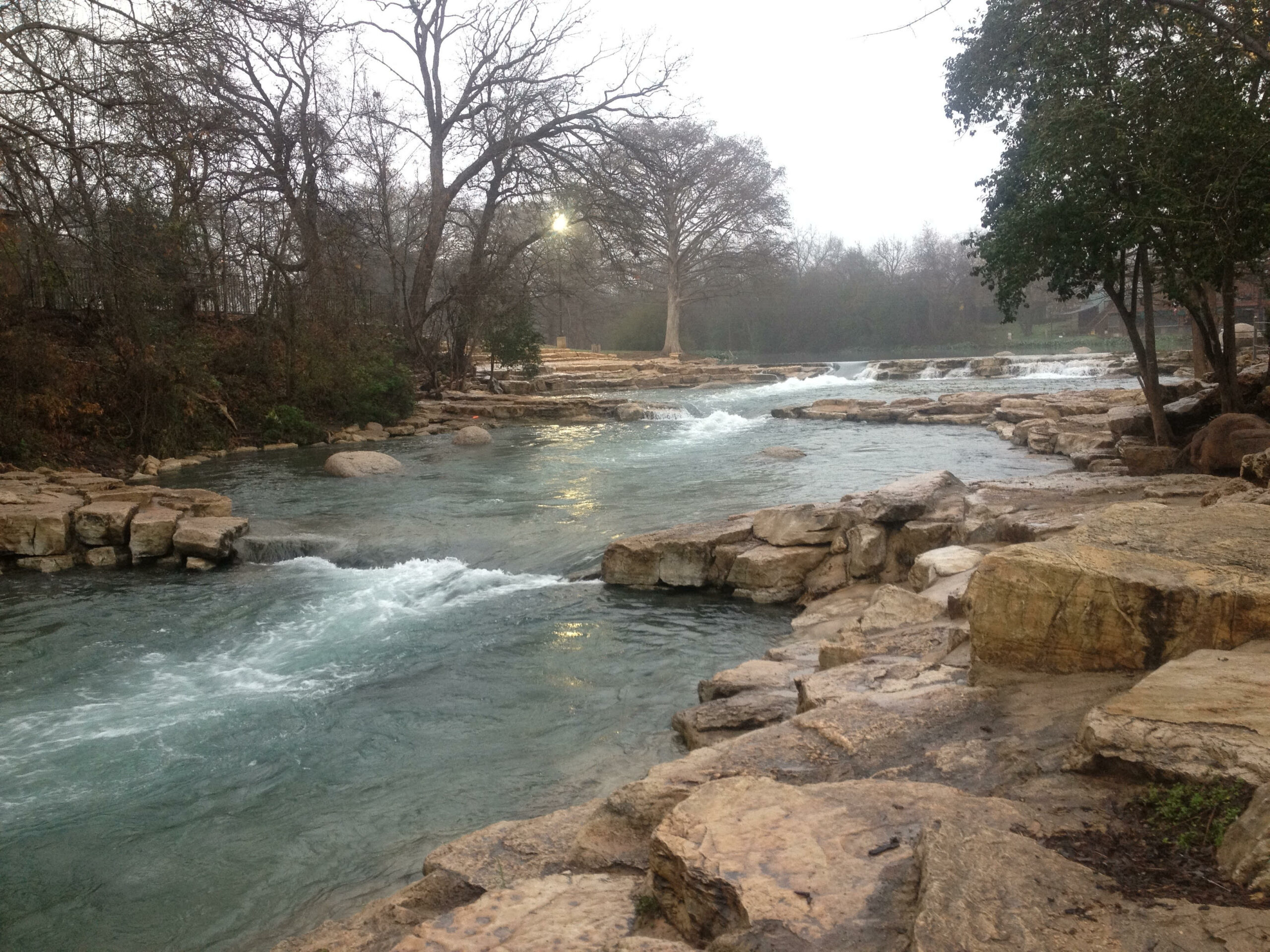
The water quality in the San Marcos River is generally very good, running clean and clear most of the time, but becoming more turbid as you move downstream. It can become muddy after recent local rainfall, and may become cluttered with debris when flooding. The San Marcos River has a tree canopy rich in riparian, aquatic and avian life. Bald cypress, Taxodium distichum, are among the biggest, tallest and longest-lived trees in Texas. Some have reportedly reached an age of 800 to 1,200 years. Bald cypress were around with the dinosaurs. When young, they’re shaped liked Christmas trees, but as they age, the crown tends to open up and the branches lift skyward, forming a massive, lofty, overarching canopy. Bald eagles and ospreys take full advantage of the height of these trees to nest on the river. Cypress are famous for their “knees”, which are thought to provide oxygen to the roots and/or to serve as anchors.
Watch this 21-minute educational documentary video: San Marcos River Project.
Conservation and Threats
- The San Marcos sadly has become host to many invasive species, both flora and fauna. The Invasive Suckermouth Armored Catfish (SAC) Hypostomus plecostomus is one that seems to have come right out of a horror movie. Texas Invasive Species Institute SAC.
- Never Dump Your Tank
- Among the Endangered or threatened species found in the Upper San Marcos, the Texas Blind Salamander and Texas Wild rice are but two of eight that are known.
- San Marcos River Foundation SMRF was established in 1985 to protect public access and preserve the San Marcos River, focusing on protecting the flow from aquifer-fed springs, improving the water quality and protecting the beauty of the area with parks and annual clean-ups.
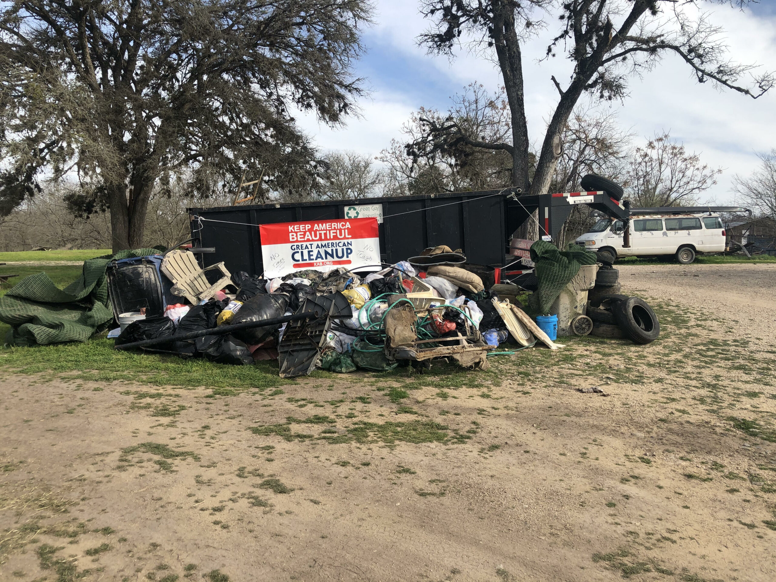
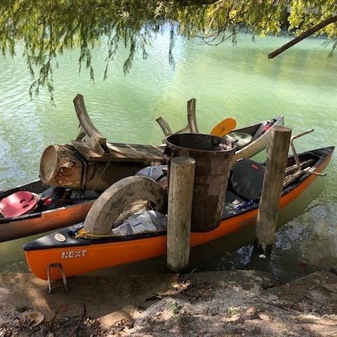
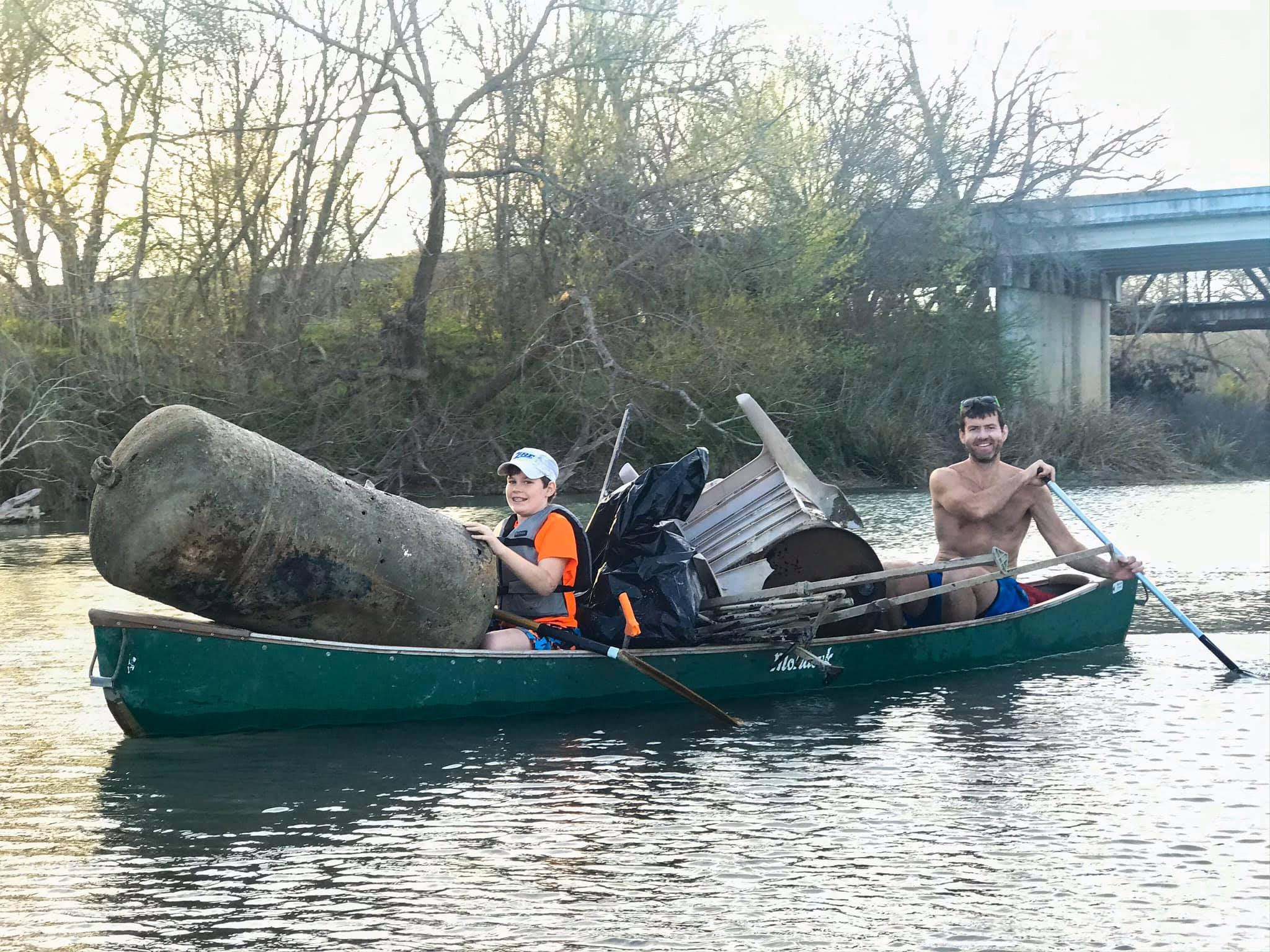
- The Great Texas River Clean Up on the San Marcos River has been held every March since 1985. It is generally held on the first Saturday of March. Please come out to help clean up the river, whether it be on the ground or from a boat.
- San Marcos River State Scientific Area Information Sheet
Historical and Cultural Significance
The springs were dammed 150 years ago, creating an underwater archeological preserve. Known as the “”River of the Innocents”” to the Spanish monks who were among the first Anglos to spy her, the San Marcos is one of the largest spring-fed rivers in Texas.
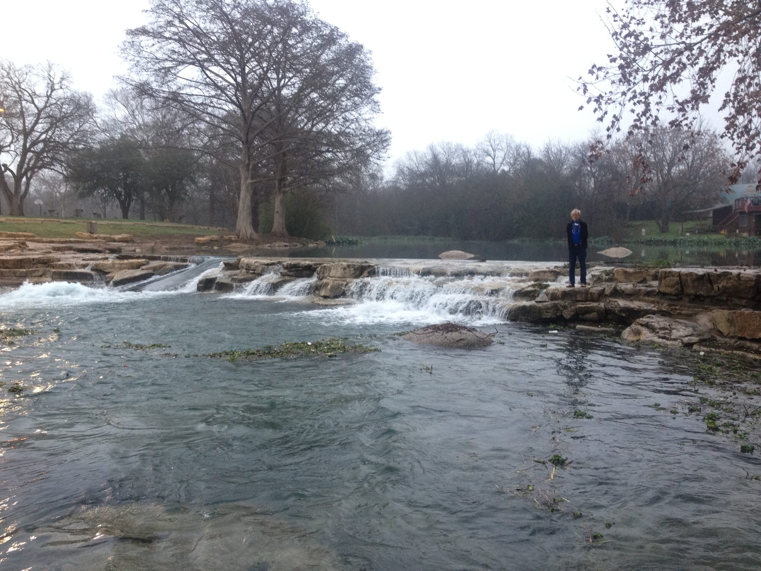
How Rio Vista Dam Became Rio Vista Falls, by Tom Goynes
Never miss an opportunity to be nice. It may pay off later.
In my case it involved the United States Geological Service and the Fire Chief of the San Marcos Fire Department. You see, the USGS operates thousands of gages on the rivers and watersheds throughout the United States. At intervals (usually every 15 minutes) you can find the flow of pretty much any river you like. Each gage measures the depth at of the river at their location on the river, and the folks at the USGS have studied (and continue to study) what flow corresponds to that depth for that creek or river. So, if for instance, the San Marcos River at Highway 80 in Luling has a depth of 4.58 feet, the flow of the river at that point, for that depth is 180 cubic feet per second. A cubic foot of water is about 7.48 gallons of water, so a flow of 180 cfs equals about 1,346 gallons of water per second. Which is about the average flow of the San Marcos River at that bridge in Luling. And, we canoeists like to know what the flow of a river is before we head out on a trip. We figure that the trip will take an average amount of time if the river is running average – or it will take longer if it is low. Or, if it is flooded, we might be wise to choose something else to do that day. Since we have this inside information, canoeists tend to be local experts when it comes to floods. We are the wizards who know how high the river is going to get hours before the floods arrive. If the Blanco River is running at 40 feet in Wimberley, we know that in about 8 hours, give or take, it will be running at 40 feet (which is a pretty good flood) in San Marcos.
And nowadays, most fire departments know about these river gages. But back in the 20th century, many did not. Or, at least Dan O’Leary, who was the Fire Chief for the City of San Marcos did not. (Read more)
Fishing
With constant flows and temperatures, the San Marcos rivals any bass fishery in the Hill Country. You will find Guadalupe, Smallmouth, Largemouth Bass, a large variety of Sunfishes and Rio Grande Cichlid. The San Marcos is home to several state records for Longear, Redbreasted Sunfishes and Guadalupe Bass. Don’t be too surprised if you catch an exotic non-native such as Koi, Pacu, Tilapia, Suckermouth catfish or other aquarium fish. If you catch one, please destroy it. Check out this TGCK video – Alex catching LMB.
- Allwater Guides Fly Fishing
- Castell Guide Service
- Expedition Outfitters
- Hill Country FlyFishers
- Fly-Fishing the Texas Hill Country, by Kevin Hutchison
Additional Resources
- San Marcos River Foundation
- Video: San Marcos River Project
- Put ins and Take outs on the San Marcos (TG Canoe & Kayak Video)
- The Eyes of the San Marcos River (Facebook)
- TG Canoe & Kayak Website – San Marcos (512-353-3946)
- Spencer Canoes & Shady Grove Campground (512-357-6113)
- Olympic Outdoor Center
- Paddle With Style – San Marcos
- San Marcos River Retreat aka Scout Camp
- Tube rentals: San Marcos Lion’s Club at City Park 512-396-5466 and Texas State Tubes.
- About river flows and gauges on the San Marcos, by Tom Goynes, 2021
- The Whole Dam Story, by Tom Goynes, 2000
- TRPA Philosophy on Public River Recreation
- TPWD Texas Rivers / Streamflow