Overview
This Class I section of the Brazos is very popular in the summer, probably due to its proximity to DFW. Also it is what remains of flowing, lotic water between De Cordova Bend Dam and lentic water of Whitney. Flow is normally dependent on releases from Lake Granbury. Friends of the Brazos River conducts annual river clean up events on this stretch in the spring.
Recreation and Access
Quick Info
| Length | 16 miles |
| Class (I-VI) | I-II |
| Minimum Flow | 50 cfs |
| Ideal Flow | 100-1,500 cfs |
| Maximum Flow | 5,000 cfs |
| Current River Conditions | USGS Hwy-67 East of Glen Rose; Brazos Basin NOW |
| Put-in map | Hwy 67 Bridge east of Glen Rose / Brazos Outdoor Center / Old low water bridge S. FM-200. |
| Take-out map | Sandlin’s Camp, Brazos Point at FM 1118 / FM 1175 |
| Boats | Canoes, Kayaks, SUP |
| Season | Year-round, weather/flow permitting |
| Highlight | This 16 miles was the last day of John Graves’ canoe trip in Goodbye To A River |
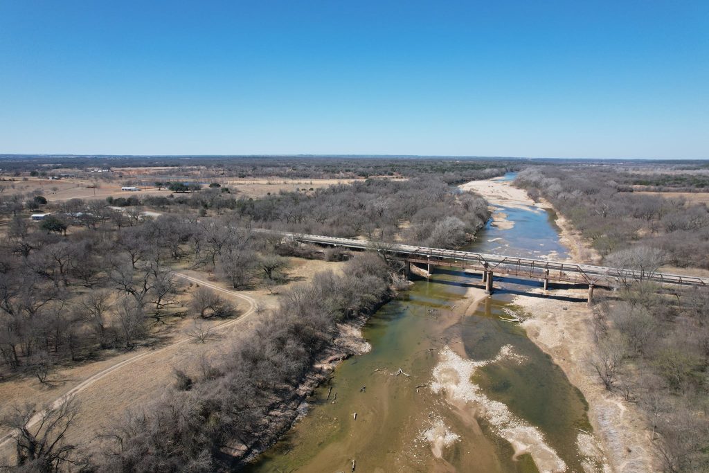
Access may be had at Brazos Outdoor Center at Hwy-67, old low water bridge at S. FM-200, river left, Sandlin’s Camp, and between the bridges at Brazos Point. At Brazos Point, the takeout on river left between the bridges is not too steep . Outfitters may have access to private property on river left above the bridges. The gravel and sand beach on river left just upstream of the bridges is a perennial tire trap where hundreds of tires have been dug up and hauled off by Friends of the Brazos River Clean Ups.
Launch Site Maps on the Middle Brazos (Seeking descriptions or details)
Lake Granbury
De Cordova Bend Dam to US-67 Bridge [31 miles]
US-67 Bridge to Sandlin’s Camp [8.3 miles]
Sandlin’s Camp to Brazos Point FM-1118 [7 miles]
Brazos Point at FM-1118 to Ham Creek at FM-1118 / SH-916 [14.8 miles]
Lake Whitney
Ham Creek at FM-1118 / SH-916 to Chisholm Trail Park – Off SH-174 [4 miles]
Chisholm Trail Park – Off SH-174 to Kimball Bend Park SH-174 [2.1 miles]
Natural Features
This part of the Upper-Middle Brazos has some small riffles and rapids with gravel bar campsite opportunities. Vegetatively, this stretch is within the Cross Timbers area. Cedar and Ashe juniper cover the hills plus elm, willow, and oaks. Sand and gravel bars provide excellent riverside campsites. Flow begins to slow just below Brazos Point as it reaches Lake Whitney.
Conservation and Threats
There are environmental challenges such as Brazos River Authority over-allocation, very inconsistent dam releases, excess algae cover and occasional outbreaks of Golden Algae. Drought is a constant challenge. Power plants contribute excessively warm water. Municipal Wastewater Treatment Plants must keep pace technologically with a quickly growing population to contain excess nutrients. The Upper and Upper-Middle Brazos have naturally high levels of salt. Gravel mining and rock quarries are a real and present danger to water quality in this stretch of river. Tires and trash are common along the river. The tires, seemingly, are on a treadmill. From ‘bridge-dumping’ to landowners who accept thousands of tires to rot in their usually dry arroyos and creeks, tires are continually feeding the river. Intense rainfall dislodges tires in every big storm that rolls across the Upper-Middle Brazos basin.
Historical and Cultural
John Graves memorialized the Upper-Middle Brazos River in his classic book, “Goodbye To A River” from his canoe trip in 1957 before De Cordova Bend Dam and Lake Granbury were created. Graves began his three week canoe trip at Hwy. 16 below Sheppard Dam and PK Lake and ended at Lake Whitney. This 16 miles stretch was the last day of John Graves’ canoe trip. This part of the Brazos was home to Comanche before the 20th Century and was a ‘Hardscrabble’ existence for many 19th and 20th Century pioneers.
Fishing
The common fishes in the Upper-Middle Brazos include catfish, smallmouth bass, white bass, striped bass, sun fishes. The record Brazos Alligator gar is 190 pounds.
Additional Resources
- Rochelle’s Canoe (FM-4)
- Brazos Outdoor Center (Hwy-67)
- Rhodes Canoe Rental (Hwy-67)
- Friends of the Brazos River
- Brazos River Angling Records