
Overview
First appearing on early Spanish maps as the Río Escondido, or hidden river, it was later named Río de las Nueces, “River of Nuts,” by early Spanish explorers and the trees were a chief source of protein to the Coahuiltecan indigenous peoples who lived there before Anglos appeared on the scene. The headwaters of the Nueces rise from aquifers in Real County and Edwards County, then flow over 300 miles south and east as it is dammed at Lake Corpus Christi. The Nueces then flows into Nueces Bay at the Gulf of Mexico. Flowing through limestone bluffs of the Edwards Plateau, the Nueces is one of the most scenic river trips in Texas. In the Upper Nueces, there are many spring-fed creeks along the way that feed the Nueces to maintain steady flows. High water levels can bring Class III rapids that can be dangerous. Another dimension of the Nueces basin are the outstanding pristinely clear tributaries Rio Frio and Sabinal. Perhaps we can explore those in more depth with your help.
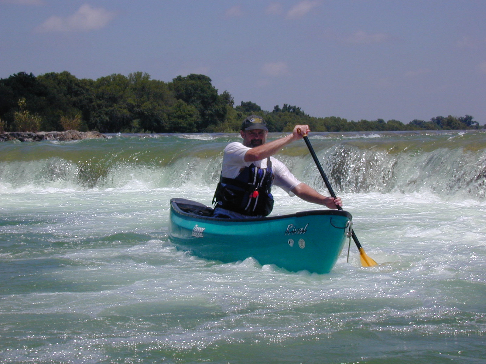
Recreation and Access
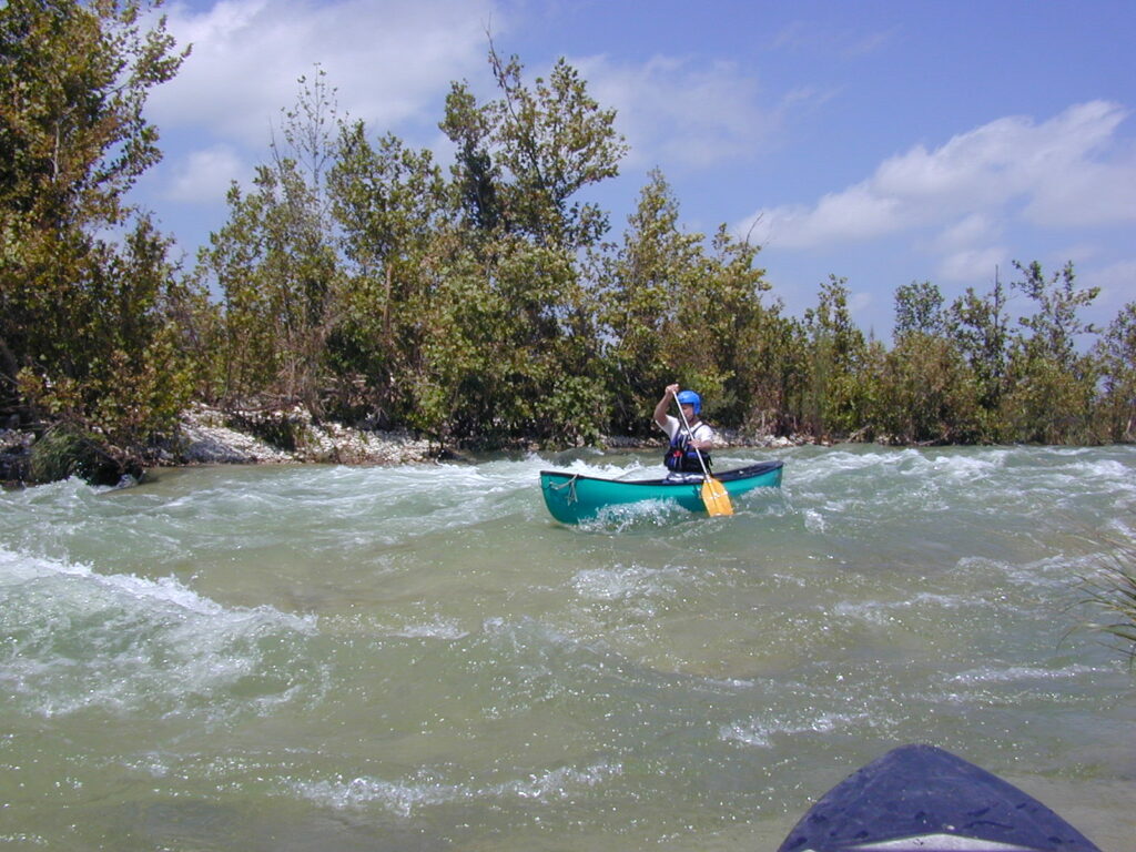
Access is good on the upper 100 miles, offering trips of various lengths. There are several privately owned and operated campgrounds suitable as base camps from which to explore different reaches of the river. The Nueces is too low to paddle much of the time, but after a good rain it is a very nice river to paddle and when the aquifers become well charged after lengthy rains, the Nueces can be a pure delight for whitewater paddlers for weeks at a time. Take all safety precautions.
| Class (I-VI) | I-III |
| Length | At least 6 runs from 4.0 miles to 12.6 miles |
| Minimum Flow | 75 cfs |
| Ideal Flow | 150-500 cfs |
| Maximum Flow | 2,000 cfs |
| Current River Conditions | USGS: Barksdale, Below Uvalde |
| Put-in maps | Barksdale, Camp Wood, CR-414, CR-408, TX-55 North of Uvalde, Chalk Bluff Park |
| Take-out maps | Camp Wood, CR-414, CR-408, TX-55 North of Uvalde, Chalk Bluff Park, CR-405 |
| Boats | Canoes, Kayaks |
| Season | Year-round, weather /flow permitting |
| Highlight | Chalk Bluffs, clear water, fun splashy whitewater |
Featured Runs
- Hwy TX-55 Barksdale to CR-390 Camp Wood [5.5 miles]
- CR-390 Camp Wood to CR-414 Montell [12.6 miles]
- CR-414 Montell to Hwy 55 North of Uvalde [11.6 miles]
- CR-408 to Chalk Bluff Resort [6.7 miles]
- TX-55 North of Uvalde to Chalk Bluff Park [4.4 miles]
- Chalk Bluff Park to CR-405 (HCR-33) [4.2 miles]
Natural Features
The basic natural feature of the Nueces River is the aquifer from which it issues, the Edwards Aquifer. The big springs that contribute to Guadalupe flow – Comal Springs and San Marcos Springs first come to mind. But many other springs of lesser flow in the Edwards Aquifer also feed many creeks of the Nueces River that make paddling possible in its upper reaches during periods without rain. The Sabinal and the Rio Frio are major tributaries of the Nueces in the Edwards Aquifer region. Vegetation along the Nueces River is diverse and includes Pecan, Hackberry, Oak, Ashe Juniper, Sycamore and Bald Cypress in the Upper Nueces Edwards Plateau and Hill Country region, giving way to Mesquite, Sagebrush and cacti of the the semi-arid coastal plains. This riparian habitat commonly sees Black-chinned Hummingbirds, Vermillion Flycatcher, Yellow-throated Warbler, Green Kingfishers, Eastern Wood-Pewee, Great Blue Herons, Red-Tailed Hawks, Turkey and Black Vultures, Aoudad sheep.
Bald Cypress, Taxodium distichum, are among the biggest, tallest and longest-lived trees in Texas. Some have reportedly reached an age of 800 to 1,200 years. Bald cypress were around with the dinosaurs. When young, they’re shaped liked Christmas trees, but as they age, the crown tends to open up and the branches lift skyward, forming a massive, lofty, overarching canopy. Bald eagles and ospreys take full advantage of the height of these trees to nest on the river. Cypress are famous for their “knees”, which are thought to provide oxygen to the roots and/or to serve as anchors.
Conservation and Threats
S.B. 155: Restricting Motor Vehicle Use In Protected Freshwater Areas, Effective September 1, 2003. In 2001, the Nueces River became the flashpoint in a controversy over ATV recreational use within Texas river streambeds. Local conservationists under the banner of Nueces Canyon River Friends sounded the alarm and sought the assistance of Texas Rivers Protection Association. In 2001 a TPWD taskforce was organized to fairly study the issues. In the 2003 legislative session, Senator Judith Zaffirini successfully led the effort and S.B. 155 was passed. Now, it is illegal to drive a motor vehicle in a linear fashion on most rivers in Texas, with the exception of Canadian River in the Panhandle.
Historical and Cultural Significance
Coahuiltecan indigenous peoples lived as far north as the Edwards Plateau in the Nueces River valley.
Conflict with Mexico continued when the United States annexed Texas as a state in 1845. Mexico claimed that the new border between Texas and Mexico was the more northward Nueces River, while the United States contested the border was the southerly Rio Grande / Rio Bravo. The Treaty of Guadalupe Hidalgo, that brought an official end to the Mexican-American War (1846-1848), was signed on February 2, 1848, at Guadalupe Hidalgo, north of the capital where the Mexican government had fled with the advance of U.S. forces. By its terms, Mexico ceded 55 percent of its territory, including parts of present-day Arizona, California, New Mexico, Texas, Colorado, Nevada, and Utah, to the United States. Mexico relinquished all claims to Texas, and recognized the Rio Grande as the southern boundary with the United States. The United States paid Mexico $15,000,000 “in consideration of the extension acquired by the boundaries of the United States” (see Article XII of the treaty) and agreed to pay American citizens debts owed to them by the Mexican government.
Fishing
Among the most common fishes in the Nueces River Basin are Striped bass, Largemouth bass, Guadalupe bass, White bass, Blue catfish, Channel catfish, Rio Grande Cichlid, Black & White Crappie, Freshwater, Red and Black Drum, Alligator gar, Spotted Seatrout, Bluegill, Redbreast, Redear and Warmouth Sun Fishes. Nueces River Angling Records
Additional Resources
- Your Remarkable Riparian – Sky Jones-Lewey, R.I.P.
- Nueces Canyon River Friends (Facebook)
- S.B. 155: Restricting Motor Vehicle Use In Protected Freshwater Areas
- Nueces River Authority
- TPWD Texas Rivers / Streamflow
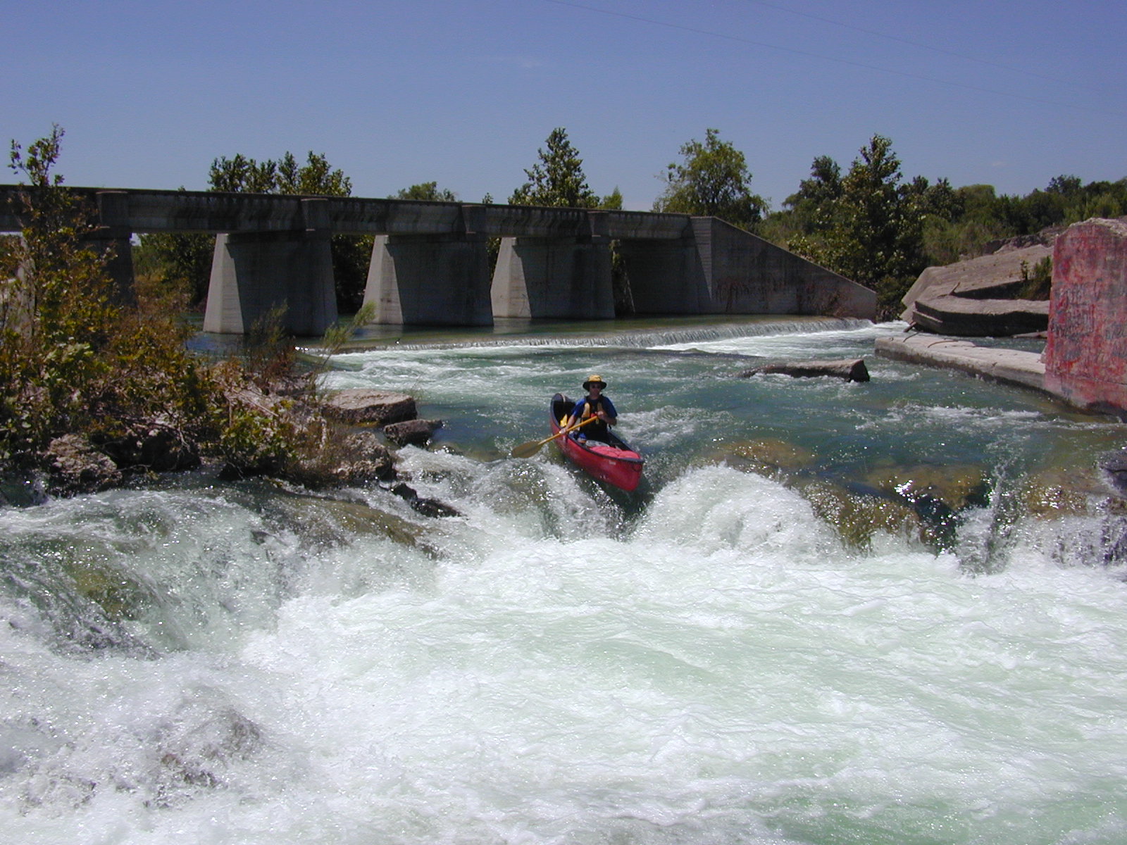
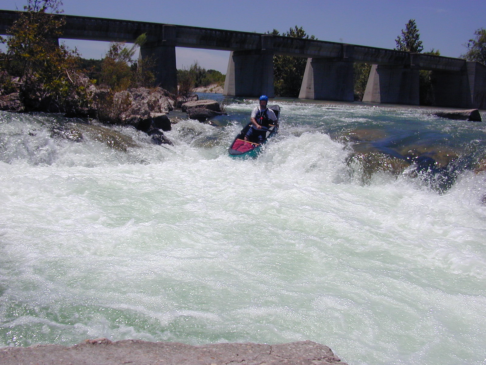
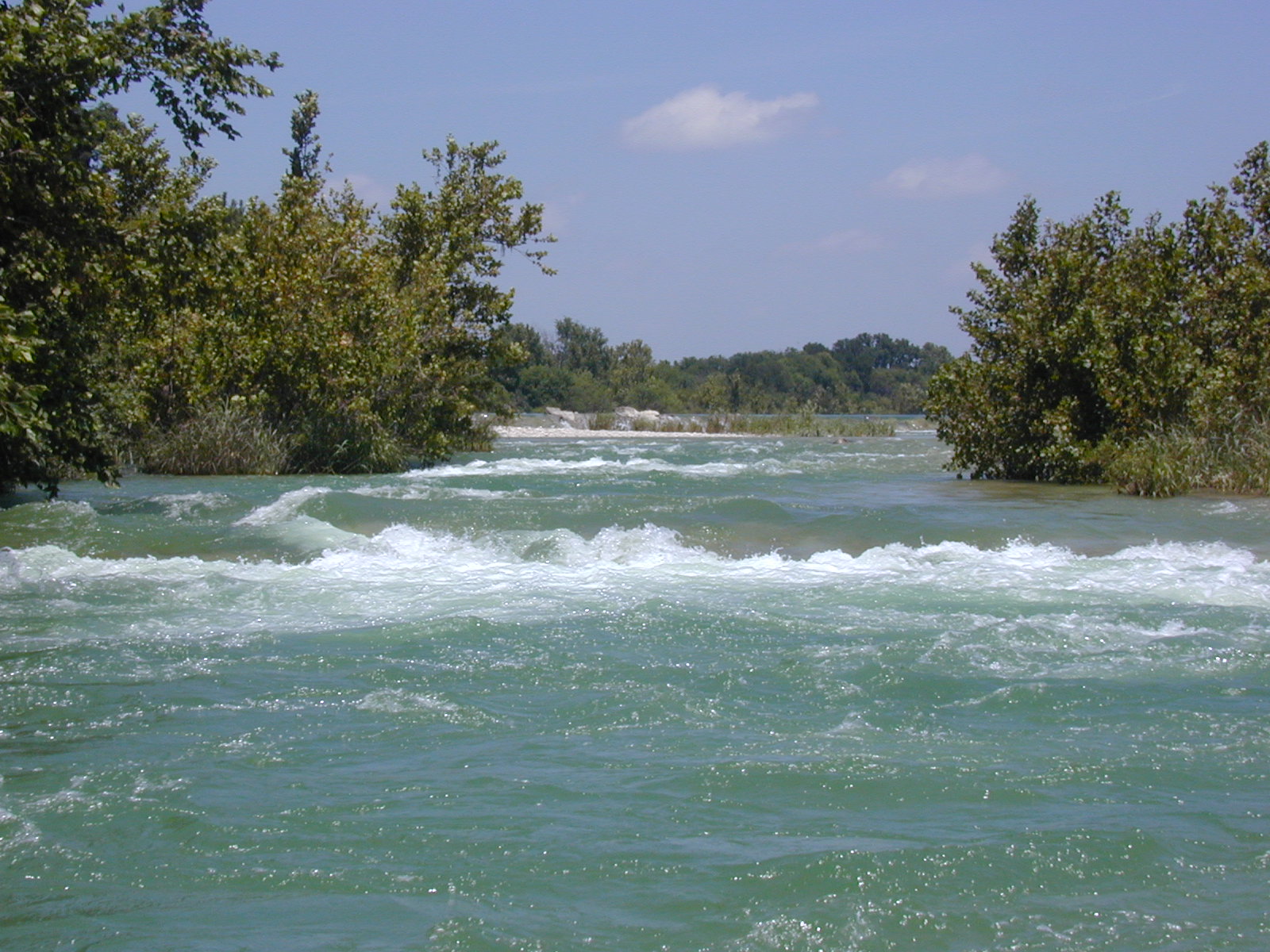


Nueces River, Photos by Mark Boyden