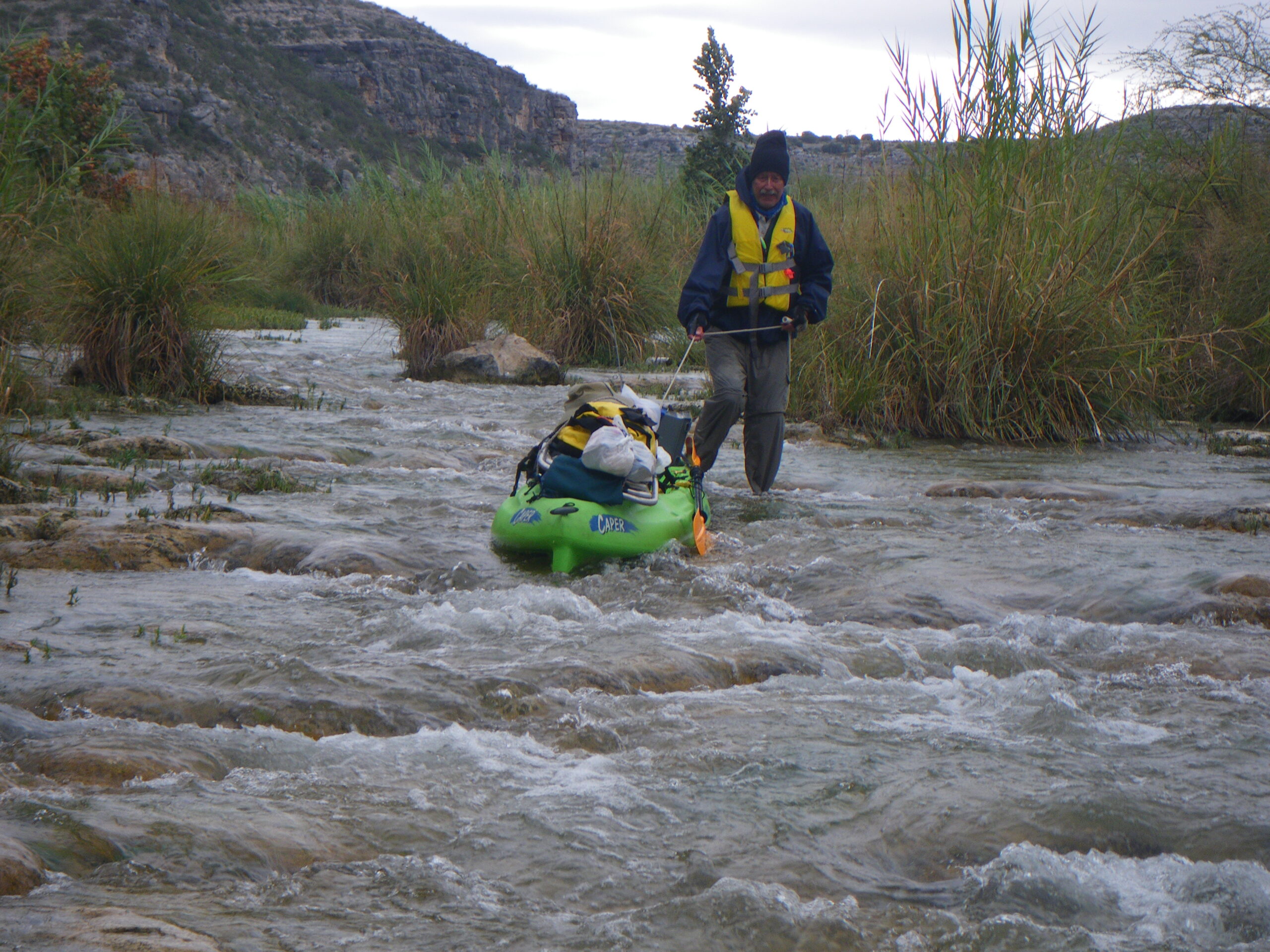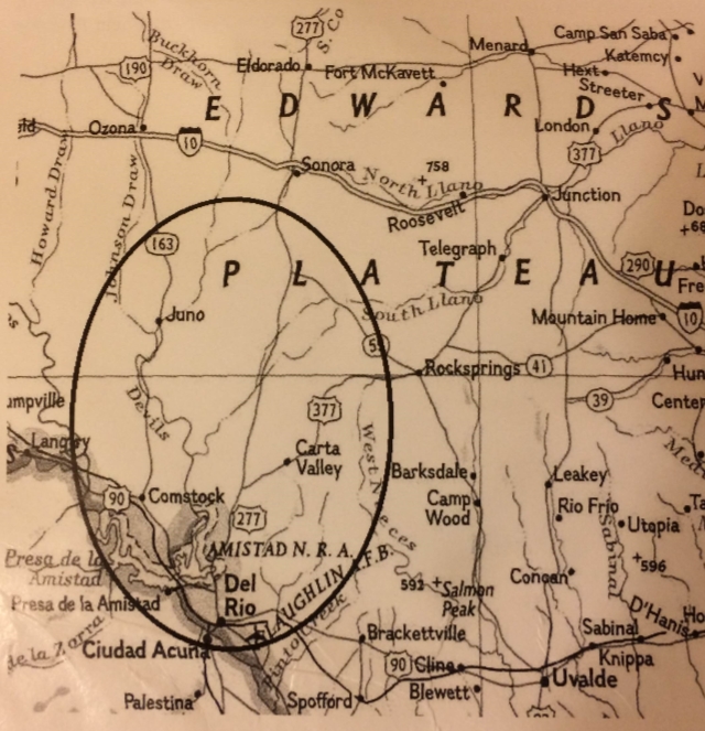
Overview
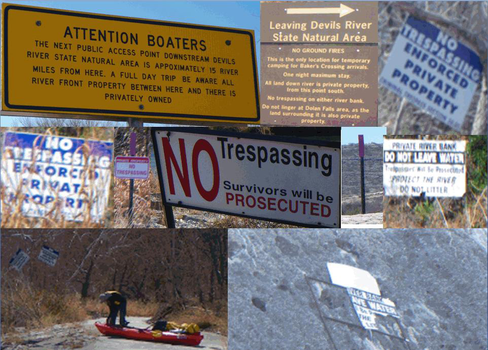
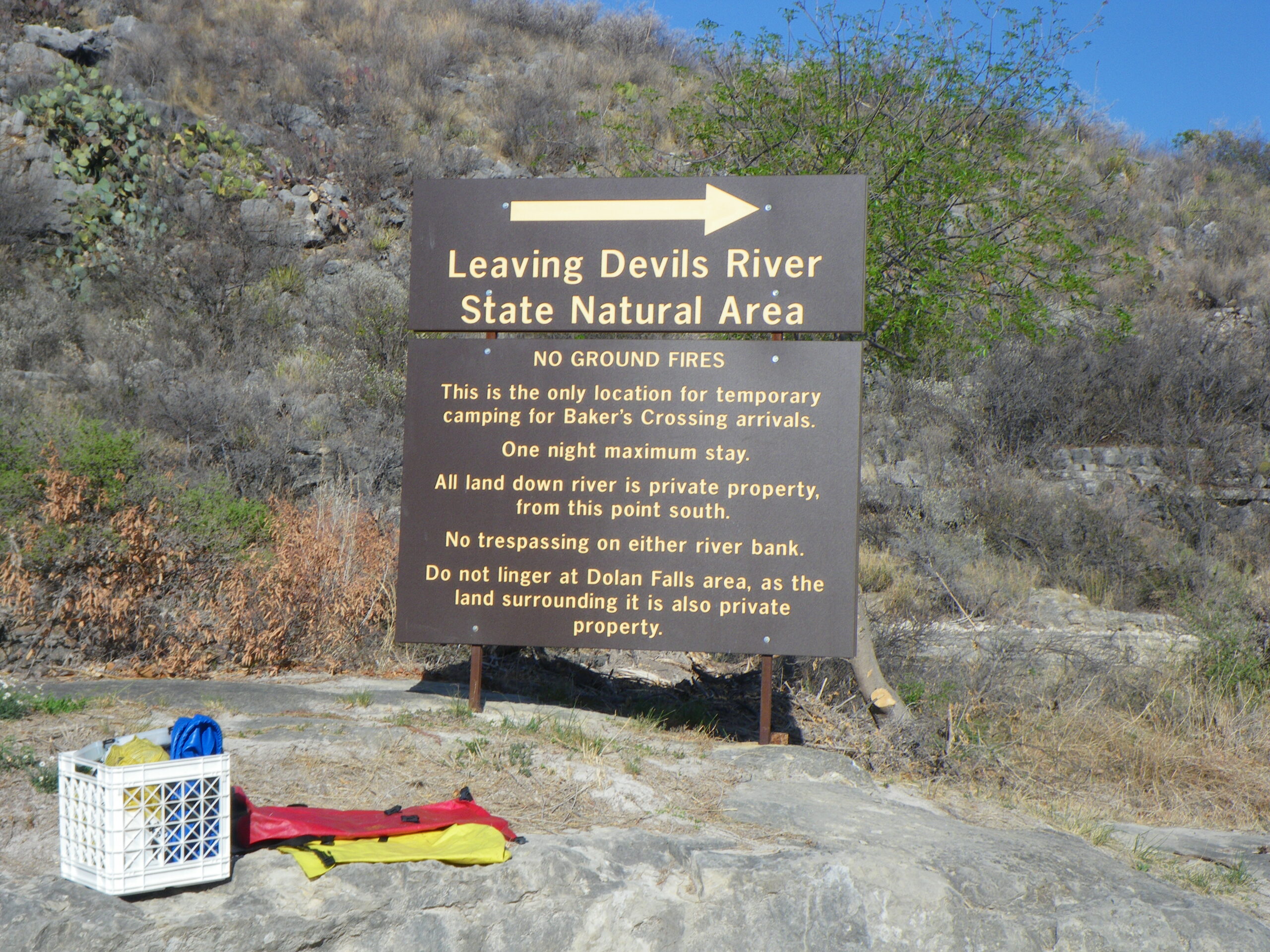
Like Bakers to San Pedro, this stretch will also eat holes in plastic kayaks like a giant cheese grater. Rent and shuttle only from a TPWD approved Devils River outfitter. DRAP & Reservations Required. Camping is always allowed on islands, but safety considerations should be taken seriously. Official Paddler Camps at M20L and M29L (DRAP & Reservations Required). Just below San Pedro camp is Dolan Falls. Be respectful of private property, including TNC Dolan Falls Preserve and please portage on river left at Dolan Falls. Blue Sage subdivision is on left at river Mile 23. Do Not Trespass. There are some probably legal camps on many low-lying slabs near the river and within the gradient boundary, but please consider the potential danger, respect private property rights and try to camp out of direct view of resident cabins and homes. Alternatively, another option for takeout is to hire a tow-out across Lake Amistad. Inquire with one of the TPWD approved Devils River outfitters about a lake tow-out.
Recreation and Access
Quick Info
| Length | 14 miles or 22.5 miles |
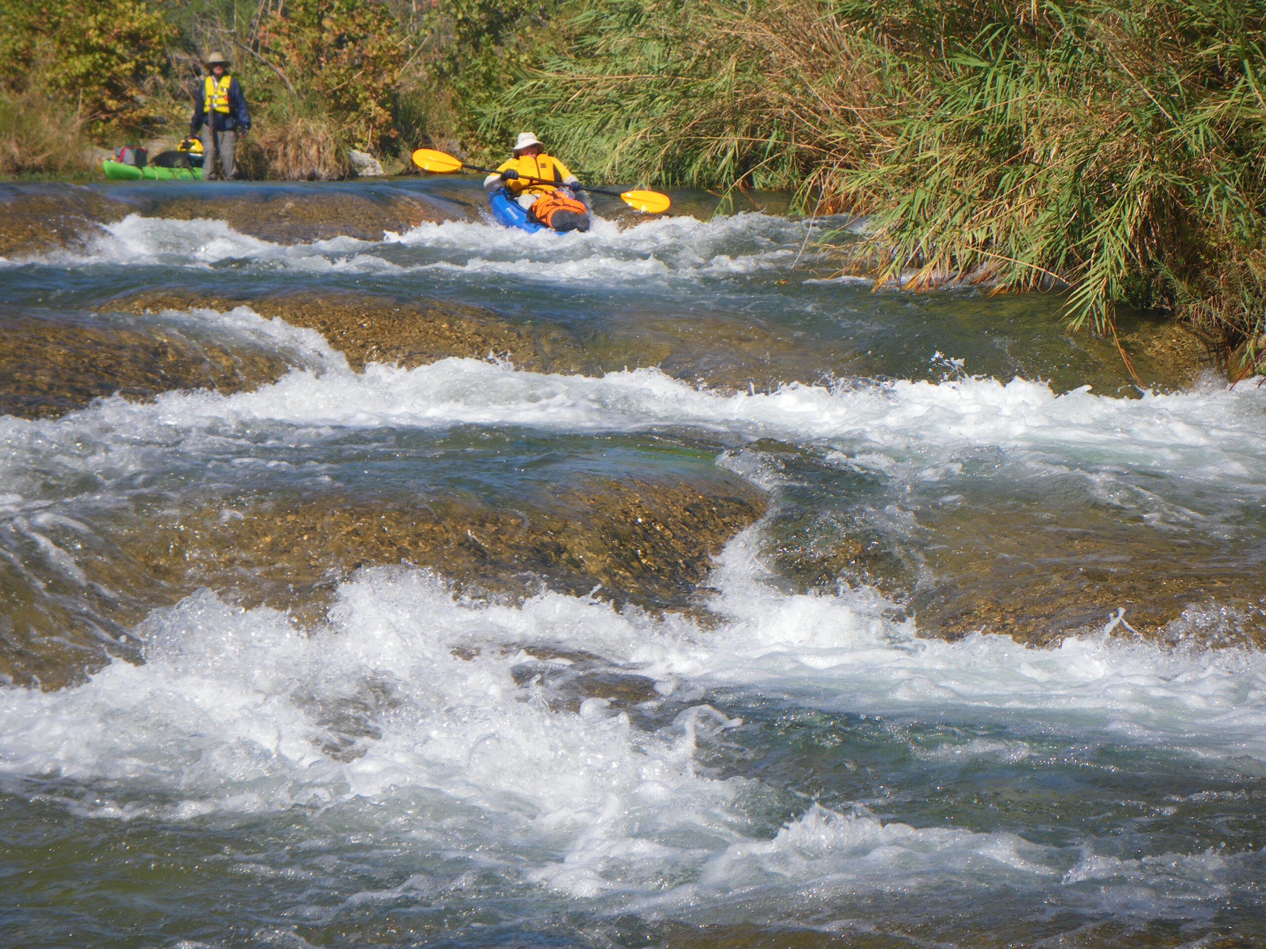
| Class (I-VI) | I-II |
| Minimum Flow | 75 cfs ( cms) |
| Ideal Flow | 100-200 cfs (2.8-5.6 cms) |
| Maximum Flow | 1,000 cfs (28.5 cms) |
| Current River Conditions | Bakers Crossing: IBWC Water Data |
| Put-in map | San Pedro DRSNA |
| Take-out maps | Devils Back (14 miles), Lake Amistad Slaughter Bend (8.5 miles) |
| Boats | Canoes, Kayaks |
| Season | Fall, winter, spring, weather /flow permitting |
| Highlight | Rock art, fishing, crystal clear water |
| Distances to DRSNA | Dallas 380 miles; Houston 410 miles; Austin 260 miles; El Paso 450 miles |
Natural Features
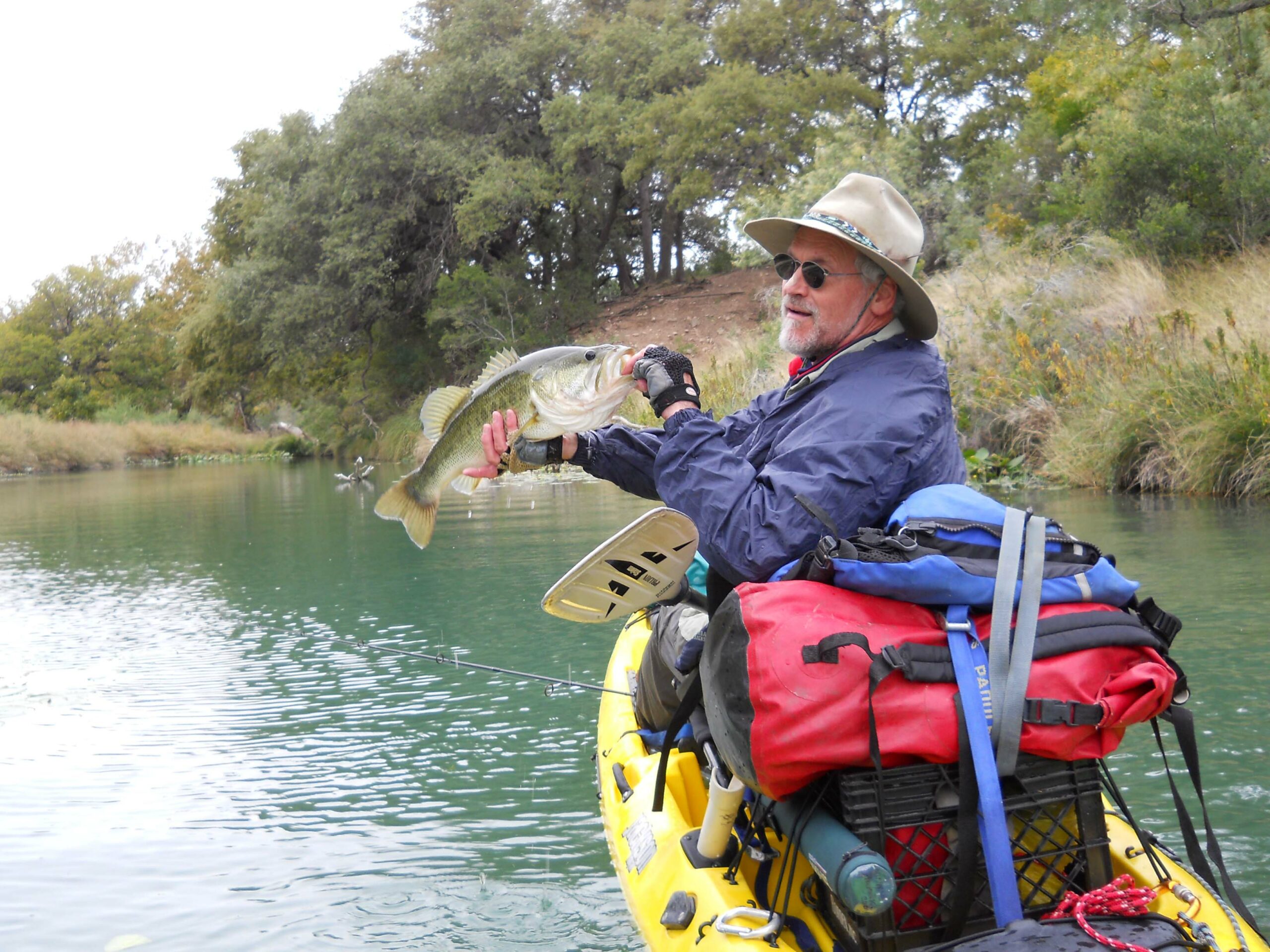
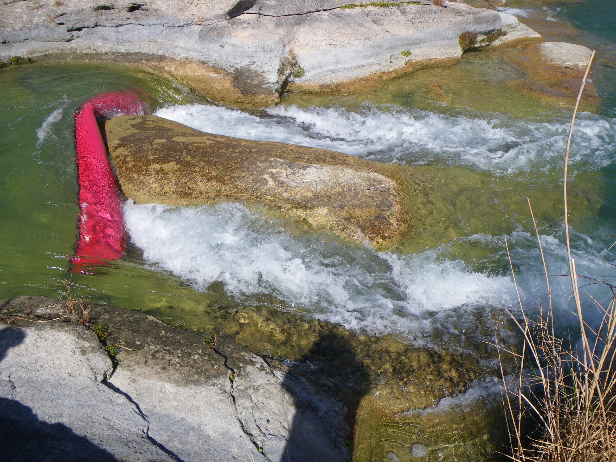
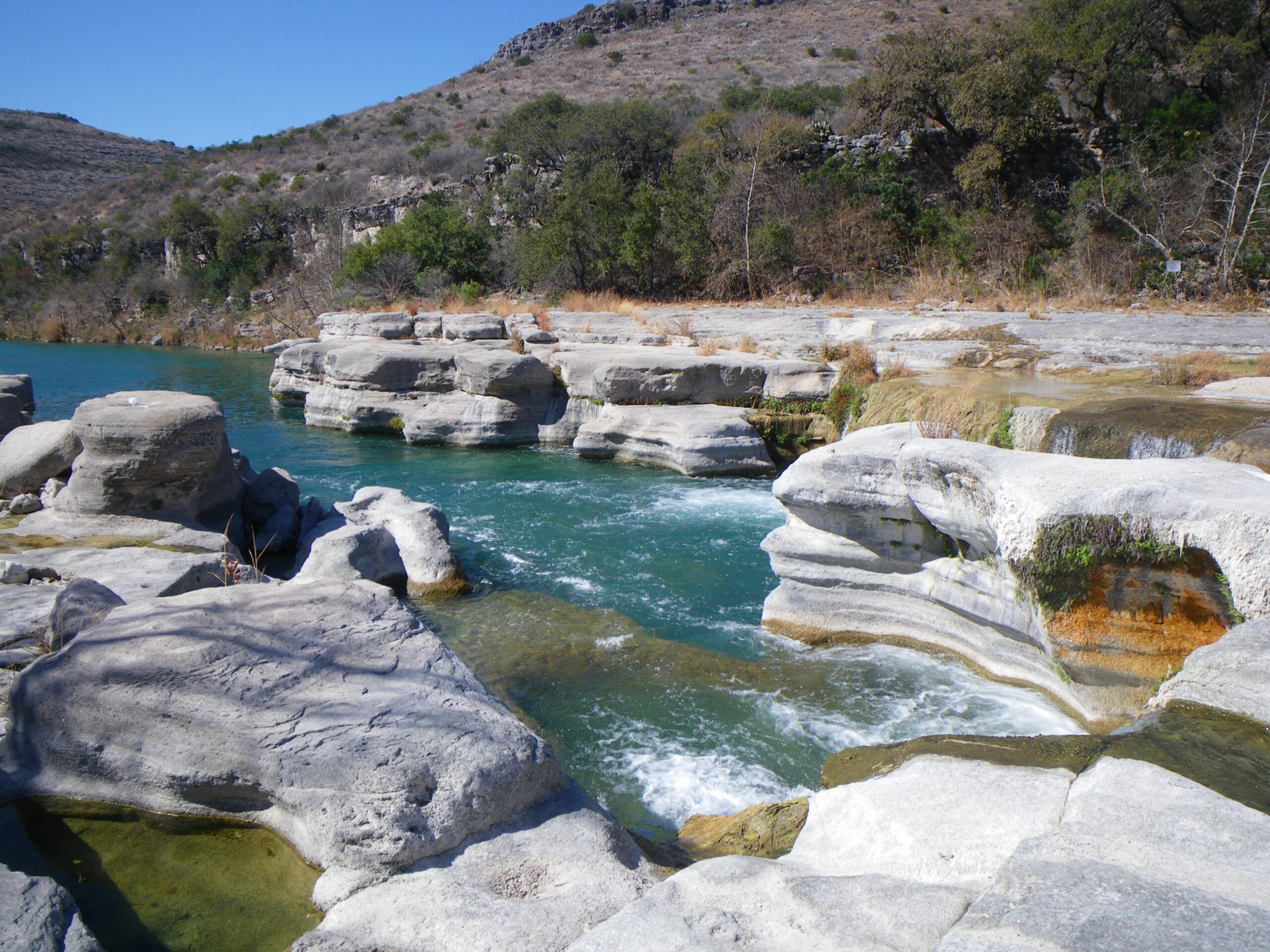
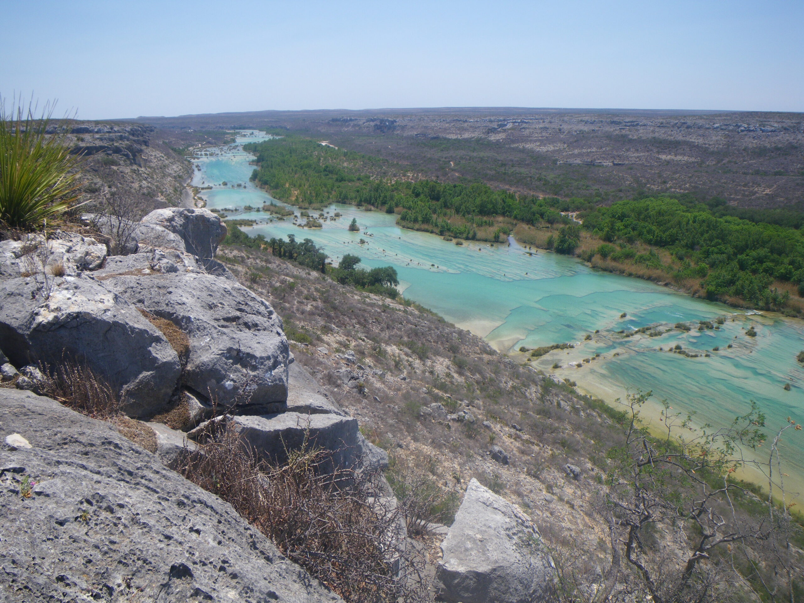
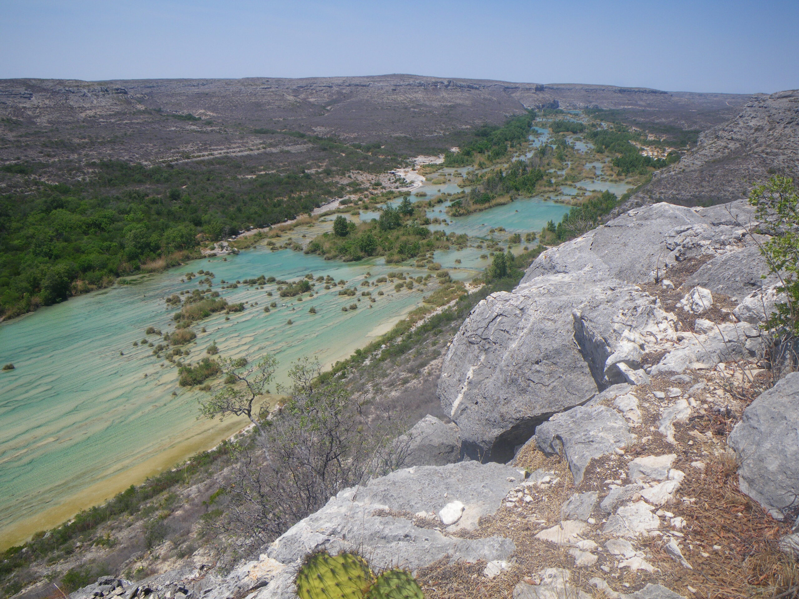
Arguably the most pristine spring-fed river in Texas, flowing over a limestone and gravel river bed. Excellent bass fishing, beautiful camps, swimming holes, magnificent examples of ancient Native American rock art. Game Warden Rock, Dolan Falls, Three-tier Rapid, Dandridge Falls, Lake Amistad. Huge biodiversity of flora and fauna as the Chihuahuan Desert, Edwards Plateau, and southern Texas Plains ecoregions meet here. Pristine water from the abundance of springs that supports state-listed threatened and endangered species including the Devils River minnow and Conchos pupfish. Golden-cheeked Warbler, Tropical Parula and Canyon wrens are common.
Historical and Cultural Significance
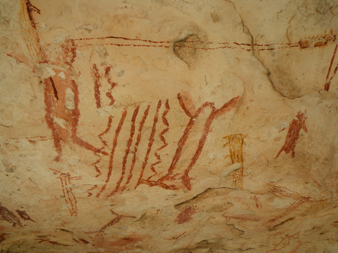
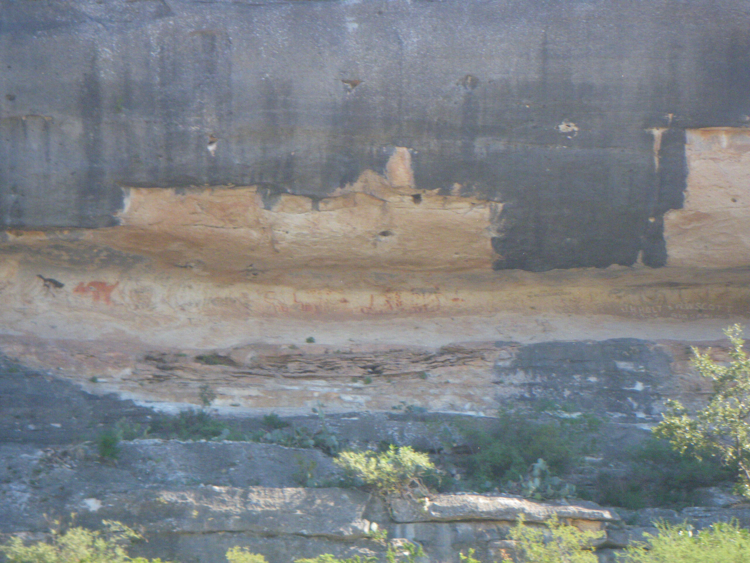
Magnificent examples of native rock art, both pictographs and petroglyphs. Traditional sheep ranching area where a 20,000 acre ranch is not exceptionally large.
Conservation and Threats
- Over-pumping groundwater
- Land fragmentation
- Recreational over-use
- Bed and bank disturbances
- Proliferation of non-native invasive species
- Inadequate stream-side septic systems
- Over-grazing
- Algae blooms
- Cultural vandalism
- Intrusive wind turbine development
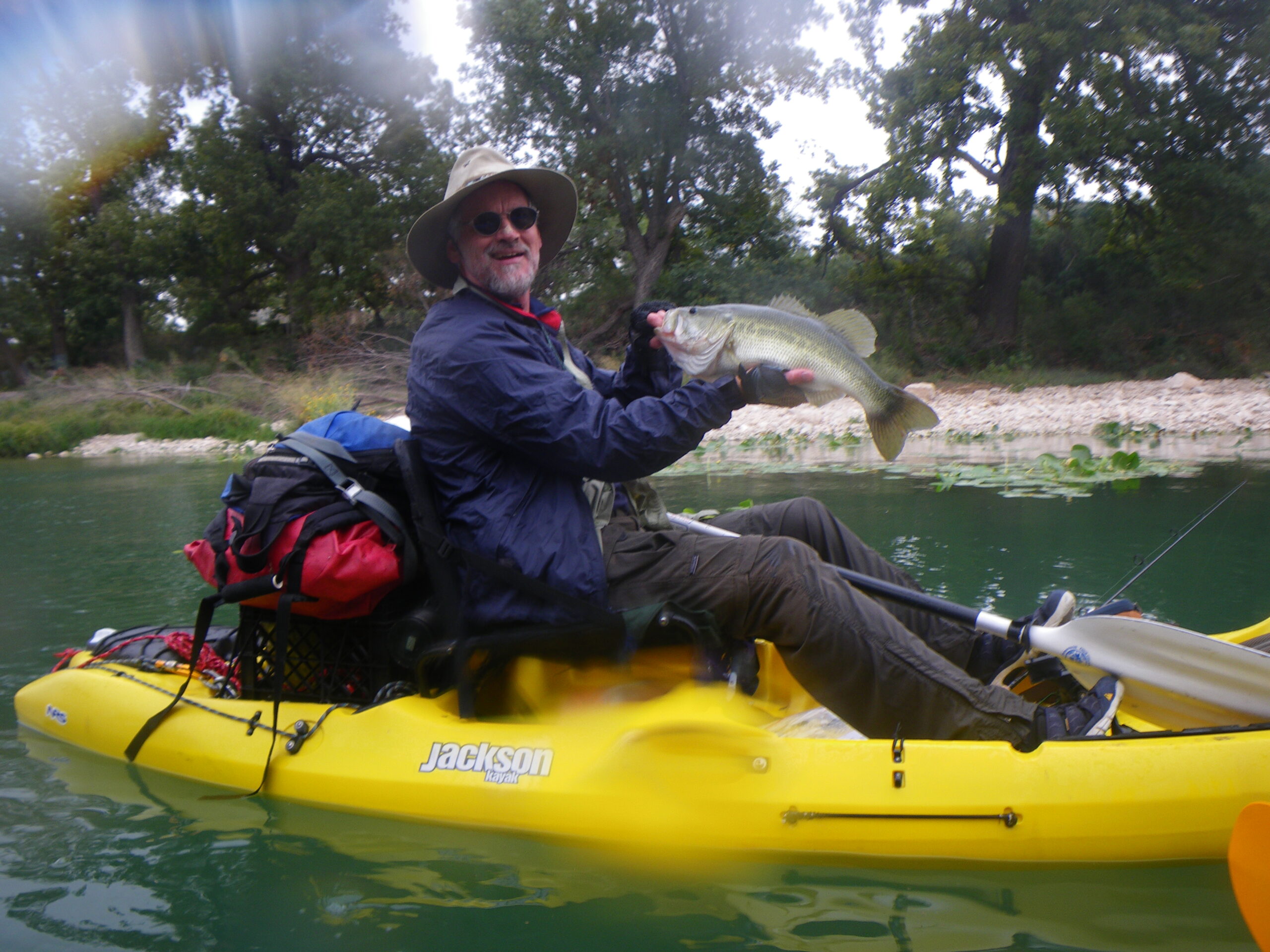
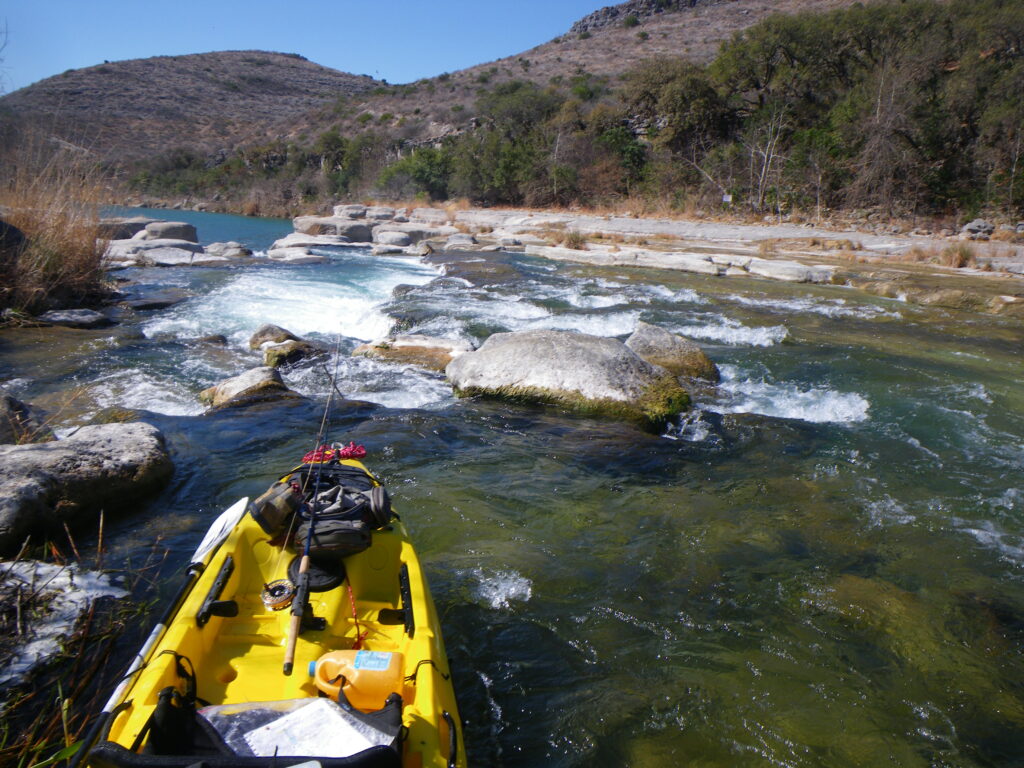
Fishing
The Devils River is a bucket list destination for fishermen. The Devils provides excellent fishing for Smallmouth Bass, Large Mouth Bass, various sunfishes, catfish and gar. Leave No Trace
Additional Resources
Preparing for a Devils River Trip
Devils River State Natural Area Web Page
Paddler camps at M12R, M15L, M20L, M29L
TPWD Texas River Guide: “If A River Runs Through It, What law Applies?”
TPWD Devils River Fishing Regulations
DO NOT TRESPASS! DO NOT LITTER! CARRY OUT ALL HUMAN WASTE!
Devils River Conservancy River Conditions
Devils River IBWC Gages (CMS x 35.3 = CFS)