Overview
The Medina is a relatively short river, only 116 miles. Its headwaters rise in the springs of northwest Bandera County, flowing southeast through Medina and Bexar Counties. The river is crystal clear with bald cypress trees lining its banks, shading paddlers. The North and West Prongs of the river have their confluence in the tiny town of Medina, where it forms the main stem that runs through the larger town of Bandera. Fifteen miles farther downstream, it forms Medina Lake. Below Medina Lake, the Medina River continues 77 miles to the confluence with the San Antonio River in southeast San Antonio.
Recreation and Access
Quick Info
| Length | Up to 8 runs of 0.4 to 12.5 miles |
| Class (I-VI) | I-III |
| Minimum Flow | 50 cfs on North Prong; 30 cfs from town of Medina and below |
| Ideal Flow | 300-1,500 cfs |
| Maximum Flow | 2,000 cfs |
| Current River Conditions | USGS: Moffett Park, Medina; USGS: City Park, Bandera |
| Put-in maps | Various put-ins, see below |
| Take-out maps | Various take-outs, see below |
| Boats | Canoes, Kayaks |
| Season | Year-round, weather / flow permitting |
| Highlight | Fun whitewater, crystal clear water, fishing. |
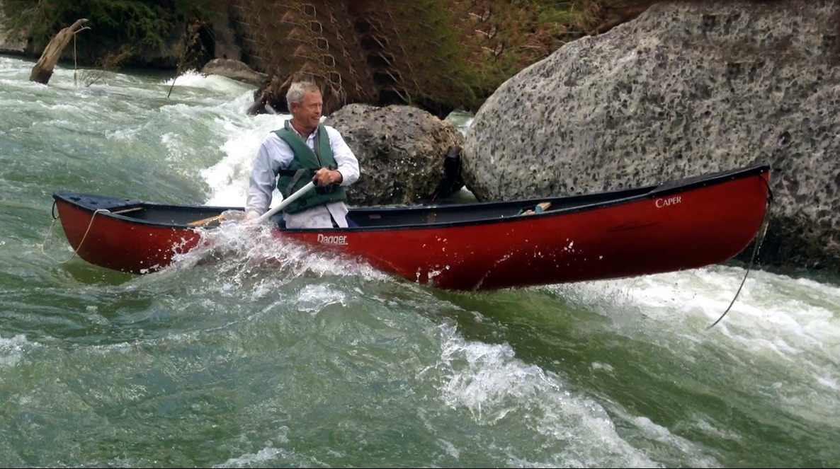
Not all of the Medina River should be considered desirable for recreational paddling. The first 49 miles of the Medina River above Medina Lake are recommended for recreational paddling if there is sufficient water flow. The West Prong is not always navigable due to low water and limited public access. The North Prong–above the town of Medina–is best known as a fly fishing destination and for whitewater paddling after a rainstorm. Chamblee Falls is a wild 10′ drop, followed by another 4′ drop soon after.
The Medina River within Bandera County is often narrow (averaging 30′-40′ wide) and meandering. During times of drought its flow may not be sufficient to float a boat. At times of sustained heavy rainfall, the river will flood. Paddlers are advised to always check current river conditions in planning their trip. Since almost all property adjacent to the river is privately owned, paddlers must not venture onto private land beyond its banks. Use the dozen or more road crossings within Bandera County to enter and exit the river.
Since the Medina River is a narrow and winding river, good navigation skills are required at high flow rates (above 300 cfs). At very low flow rates (below 20 cfs) considerable dragging will be necessary and good-fitting water shoes are recommended for walking over “wagon wheel tracks” (grooves in the limestone bottom). The USGS reports readings of less than 61 cfs half of the time near the Bandera City Park. At Moffett Park in the town of Medina, the USGS reports readings of less than 13 cfs half of the time over the past decade.
Featured Runs
The river can be accessed at any of a dozen public road crossings in the almost 49 miles of river recommended in the featured runs. Contact Robert Brischetto (210-413-7264) for more detail and discussion of the put-in and take-out points.
Launch Site Maps
- North Prong Medina
- 3rd Crossing of FR2107 to Freeman Crossing at SH16 [6.6 miles]
- Freeman Crossing at SH16 to Moffett Park, Medina [6.3 miles]
- Main Medina
- Moffett Park, Medina to Bandina Camp Rd. [6.7 miles]
- Bandina Camp Rd to Peaceful Valley Rd Crossing [3.5 miles]
- Peaceful Valley Rd. Crossing to Ranger Crossing at Hwy 16 [3.8 miles]
- Video: Medina River (Peaceful Valley Rd.) to Ranger Crossing (3.75 miles, 139 cfs) by TG Canoe & Kayak)
- Ranger Crossing at Hwy 16 to Crossing at CR 470 Bridge [.4 mile]
- Crossing at CR 470 Bridge to Bandera City Park Dam [5.25 miles] !DAM! THIS RUN INCLUDES A MANDATORY PORTAGE AT MAYAN RANCH ROAD! DO NOT RUN THE DAM AT CITY PARK TAKEOUT!
- Bandera City Park Dam to English Crossing [12.5 miles] !DO NOT RUN THE DAM AT CITY PARK!
Campgrounds, Rentals and Shuttles
The only camping along the Medina River available to the public is at the Pioneer River Resort, 202 Maple Street, Bandera (across SH-173 from the Bandera City Park). Reservations are required at (830) 796-3751. Hot showers, swimming pool and RV hookups are available.
There are also hotel, motel and RV accommodations available in the town of Bandera on and near the Medina River. Contact Bandera Visitor Center at (830) 796-3045.
There is no canoe rental available in Bandera County. Kayaks, tubes and shuttles can be rented from the Medina River Company, 1114 Main Street, Bandera (830) 796-3600.
Natural Features
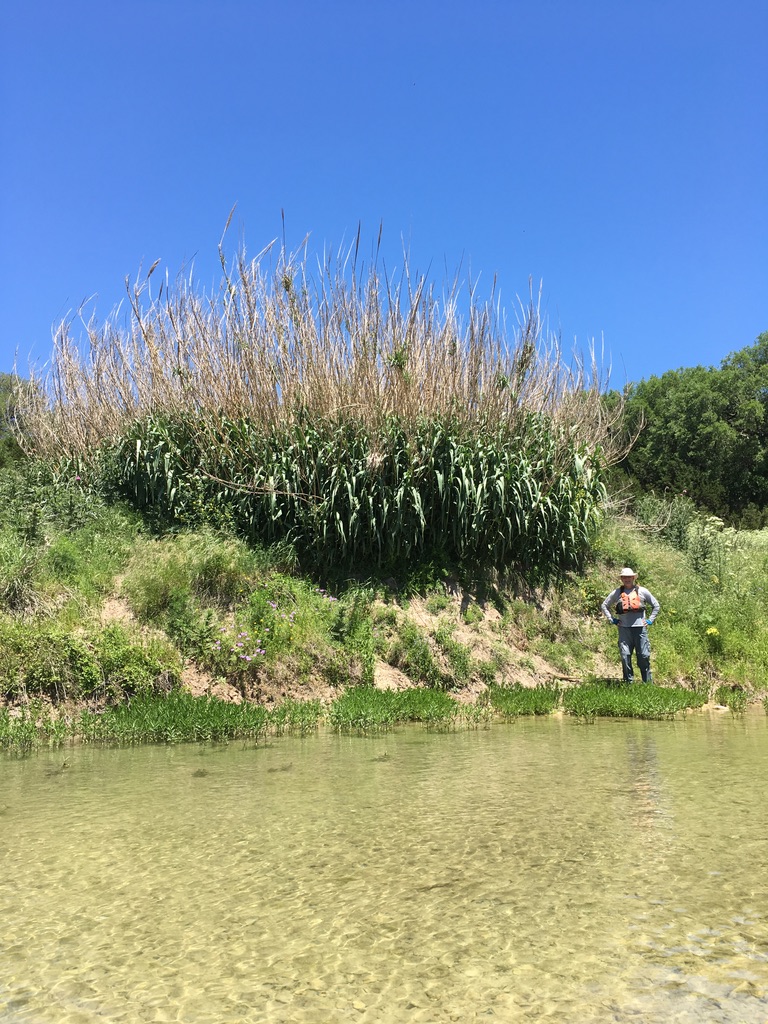
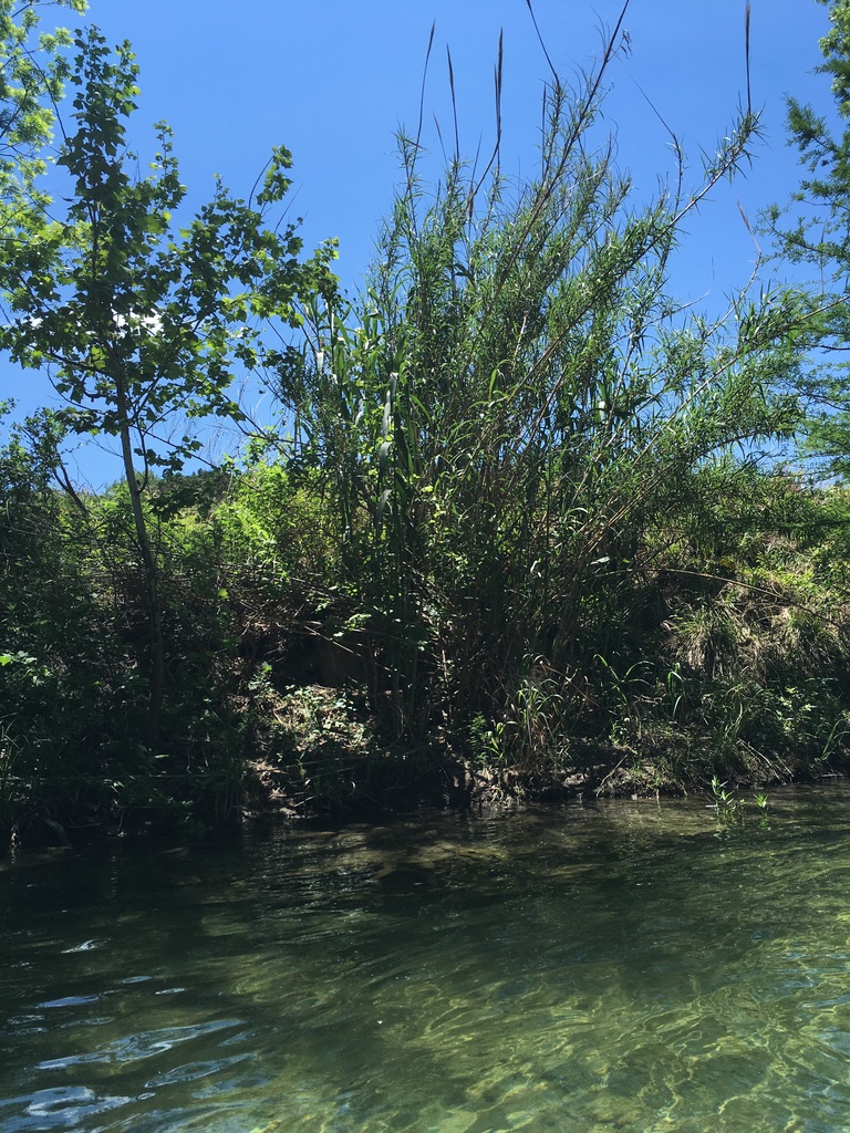
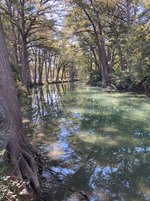
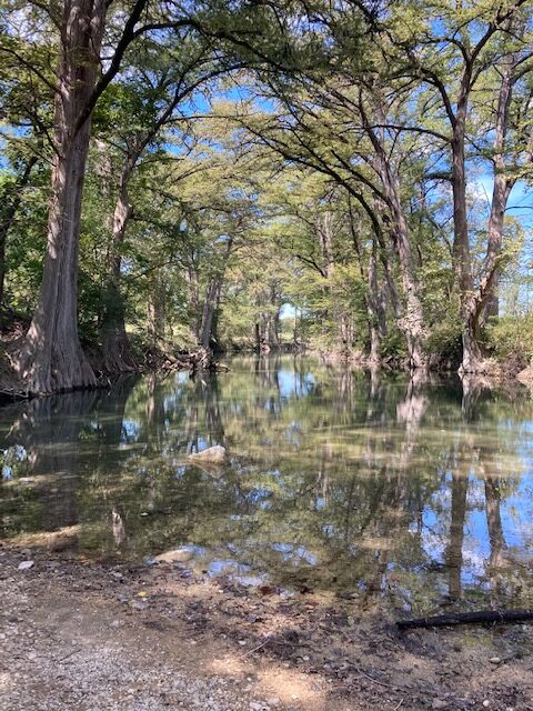
The water quality is generally good throughout the Medina River basin and is best above the town of Bandera. As a spring-fed river, its waters are crystal clear with bald cypress trees lining its banks, shading paddlers.
Bald cypress, Taxodium distichum, are among the biggest, tallest and longest-lived trees in Texas. Some have reportedly reached an age of 800 to 1,200 years. Bald cypress were around with the dinosaurs. When young, they’re shaped liked Christmas trees, but as they age, the crown tends to open up and the branches lift skyward, forming a massive, lofty, overarching canopy. Bald eagles and ospreys take full advantage of the height of these trees to nest on the river. Growing naturally in or near water, the Bald cypress lines the Upper Medina River as well as other Hill Country rivers. Famous for its knees, the bald cypress is thought to provide oxygen to the roots or to serve as anchors.
Ashe Juniper, Juniperus ashei, is also called mountain cedar. Ashe juniper provides an evergreen fragrance and nesting material for the Golden cheek warbler. Much of the woodlands of the Upper Medina River valley are Ashe Juniper.
Conservation and Threats
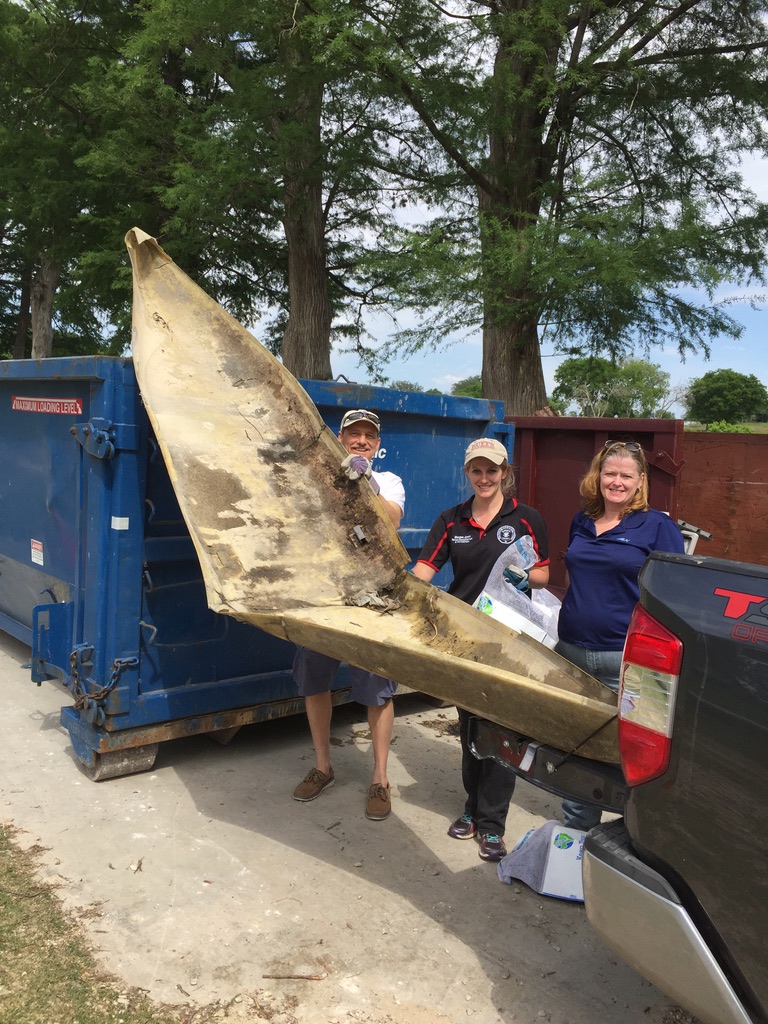
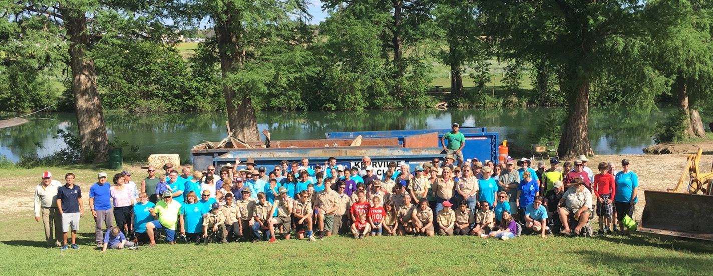
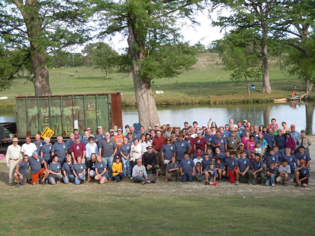
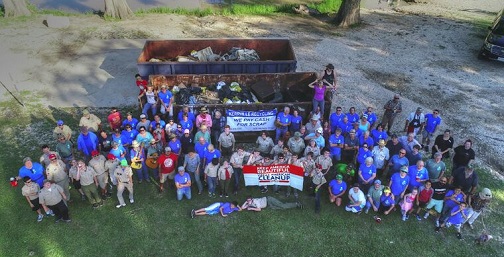
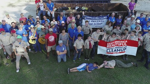
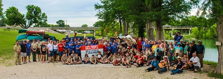
All Hill Country rivers are facing water quality degradation from municipal wastewater treatment plants and substandard septic systems. From 2007 to 2013, TRPA funded a contested case hearing with TCEQ to prevent the city of Castroville from dumping treated sewage into the Medina and to improve water treatment facilities at Castroville. The Medina River Protection Fund stages a river cleanup on the Medina River every first Saturday in May. Since 2001, an average of 200 persons have participated each year in the event (with the exception of 2020 and 2021, when it was canceled during the pandemic).
The water quality is generally good throughout the Medina River basin and is best above the town of Bandera. The primary negative impacts on the river environment include:
- Serious algae mats cover the Medina River much of the time below the city’s sewage treatment plant, just below the crossing of SH 173 in downtown Bandera. Excessive nutrients make their way into the river which contribute to these explosions of algae growth.
- Outcroppings and spread of invasive Arundo Donax (aka Giant Reed) threatens to rearrange the river flow, and crowd out native species of flora and fauna. A program is underway by the Bandera County River Authority and Groundwater District, but eradication is slow and incomplete.
- Unacceptable levels of E. Coli and other bacteria have been found in the Bandera City Park and swimming is not advised in the river near the Bandera City park dam.
Historical / Cultural Significance
Long before the first European set foot on the banks of what is now known as the Medina River,
indigenous people who had inhabited the area found the river to be a source of water and
food. Alonso De Leon, governor of the state of Coahuila, was mapping his route north through
the wilderness when he noted in his diary that he named the stream for Pedro Medina, a
Spanish engineer who provided the navigation tables for the exploration. It was shown as
running to the Gulf of Mexico and later used as the boundary between Tejas and Coahuila. The San
Antonio River was regarded as its tributary; although, that was reversed in later designations.
The Battle of Medina was fought southeast of San Antonio de Bejar on August 18, 1813, by the
Republican Army of the North, who were defeated in their effort to gain independence of
Mexico from Spain. Two decades later, after Mexico had won its independence, Antonio Lopez
de Santa Anna used the same spot on the river to gather his forces for the final approach to San
Antonio in the Battle of the Alamo.
The recurrence of floods along the river revived the idea of a more substantial dam in the box
canyon of the Medina. Alex Walton, who had visited the canyon in 1894, interested fellow
engineers, Frederick Stark Pearson and Clint Kearney to design and build a dam with canals to
carry water to farms along the lower Medina valley near Natalia. After raising the funding
here and abroad, construction was finished in a year’s time in 1912. That was the beginning of
Medina Lake. The river still experiences floods on occasion, as on August 2, 1978, when
unofficial rainfall total of 48 inches was reported along the river’s north prong in 24 hours,
taking 22 lives and causing millions of dollars of damage. Another 100-year flood in 2002 raised the lake ten feet above the dam’s spillway.
Fishing
The Upper Medina provides crystal clear water and excellent kayak fishing for various Sunfishes, Largemouth Bass and Smallmouth Bass. The best access and-fly fishing on the Medina includes 28 miles of the North Prong from along FR-2701 North Prong Creek Road and good fly-fishing as well down to Bandera . An excellent guidebook is Fly-Fishing the Texas Hill Country, by Kevin Hutchison.
- Hill Country FlyFishers
- Fly-Fishing the Texas Hill Country, by Kevin Hutchison
- Angling records for Medina River
Additional Resources
- Medina Protection Fund
- Video: Medina River (Peaceful Valley Rd. > Ranger Crossing) [3.8 miles, 139 cfs] by TG Canoe & Kayak)
- Trip Report: Bandera to English Crossing [800 cfs] by Saturday Paddlers
- Trip Report: Ranger Crossing to Bandera [275-400 cfs] by Boats and Balls Blog
- Trip Report: Medina River Clean Up by Saturday Paddlers
- Fly-Fishing the Texas Hill Country, by Kevin Hutchison
- Angling records for Medina River
- Medina River Company, Bandera
- Chamblee Falls on the North Prong Medina, 2010
- TPWD Texas Rivers / Streamflow
- Bandera County River Authority and Groundwater District
- Video: Mexican Creek – Lake Medina Spillway Class III-IV Kayaking