
Overview
Trinity Coalition Maps & National Paddling Trails Info
In north Denton County between Ray Roberts Dam and Lake Lewisville, there are 11 miles of paddling before Lake Lewisville starts to back up. With one launch at the Ray Roberts Dam and two highway crossings, there are two runs available between the lakes totaling 11.2 miles.
As the Elm Fork exits Lake Lewisville Dam, the river generally flows clear and cool for about eight miles. Occasionally, dangerous log jams may develop after flooding.
Typical flows are between 100-400 cfs which is adequate for paddling upstream or downstream.
Recreation and Access
Quick Info
| Length | Up to 13 trails from 1 to 10 miles |
| Class (I-VI) | I |
| Minimum Flow | 100 cfs |
| Ideal Flow | 200 – 1,000 cfs |
| Maximum Flow | 2,000 cfs |
| Current River Conditions | USGS 380 Prosper; USGS Carrollton; USGS Denton Creek; |
| Put-ins | Check with Trinity Coalition maps and info. |
| Take-outs | Check with Trinity Coalition maps and info. |
| Boats | Canoes, Kayaks |
| Season | Year around |
| Highlight | Lots of choices |
Featured Runs
Launch Site Maps and Paddling Trails
- Ray Roberts Greenbelt1 to Greenbelt 4282 (4.4 miles) 1,2 Not an official paddling trail launch site.
- Greenbelt 4282 to Elm Fork at Highway 3803 (6.8 miles) 2,3 Not an official paddling trail launch site.
- Beaver Pond Paddling Trail at LLELA (1 mile loop)
- Elm Fork, Lewisville Dam to Hebron, Trinity Fork Park (6 miles)
- Elm Fork, Hebron, Trinity Fork Park to McInnish Park (5.75 miles)
- Elm Fork, McInnish Park to Denton Creek (4-10 miles)
- Grapevine Lake Paddling Trail (3.8-9.4 miles)
- Elm Fork, Carrollton Dam to Elm Park / DimensionTract / Beltline (1.1 miles)
- Elm Fork, Elm Park / Beltline to Bird’s Fort (6.4 miles)
- Elm Fork, Bird’s Fort to California Crossing (2 miles)
- Elm Fork, California Crossing to Frasier Dam Takeout (5.5 miles)
- Elm Fork, Frasier Dam to Trinity View Park [Under Construction] (3.3 miles)
- Elm Fork, Trinity View Park [under Construction] to Trammel Crow Park (5 miles)
Natural Features
Vegetational Areas in the Upper Trinity Basin are Cross Timbers & Prairies in the west through Tarrant County, changing to Blackland Prairie as you move eastward in Dallas County to the Elm Fork and downstream into the Main Stem Trinity. Although much of the Elm Fork was diverted and channelized after 1910, parts of the Elm Fork above Frazier Dam retain their natural meanders and many 100+ year old large Elm (of course), Bur Oak and Post Oak still remain there on sentry today. Cottonwood, Willow, Ash and Box elder are among the other dominant trees of the Elm Fork.
Canoeing the Elm Fork of the Trinity River, by Ben Sandifer
Historical / Cultural Significance
The Elm Fork and Denton Creek are both dammed and create three of the largest reservoirs in North Texas: Ray Roberts, Lake Dallas / Lewisville and Grapevine lakes.
The historical site of Bird’s Fort is recognized to be in present day Euless north of the West Fork and 1.25 miles NNE of River Legacy Park.
Bird’s Fort was named for Major Jonathan Bird, who established a garrison in September 1841 near present day Arlington, for protection of settlements along the Texas frontier. The fort was constructed after the Battle of Village Creek, May 24, 1841. The military installation was the site of the Treaty of Bird’s Fort, 1843, negotiations between tribal Indians and Anglo settlements in the area.
Republic of Texas President Sam Houston had made it one of his top priorities to end hostilities with the Indians. On July 1, 1842, Houston appointed a commission to “treat with any and all Indians on the Frontiers of Texas.” A treaty was intended to end years of hostilities and warfare between the Native Americans and the Anglo settlers in Texas. The full title of the treaty was “Republic of Texas Treaty with the Indigenous Nations of the Delaware, Chickasaw, Waco, Tawakani, Keechi, Caddo, Anadahkah, Ionie, Biloxi, and Cherokee.” The principal negotiators for the Republic of Texas were Edward H. Tarrant and George W. Terrell. Having lost many of their young men in wars with the Anglos, the tribes were apparently amenable to a treaty, On March 31, 1843, after several false starts, the chiefs of the ten tribes agreed to a council of peace. The council and the commissioners met six months later and concluded a peace treaty on September 29, 1843. The meeting was held and treaty was signed at Bird’s Fort north of West Fork Trinity River at present-day Euless. The Senate of Texas ratified part of the treaty on January 31, 1844. President Houston signed the treaty on February 3, 1844 in Washington, Texas.
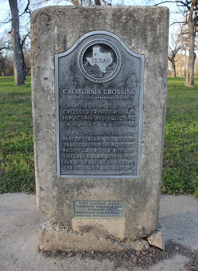
One of the launch sites on the Trinity River National Water Trail is California Crossing. People sometimes ask how California Crossing got its name. An old Texas Historical Marker there reads, “Here thousands of 49’ers crossed Trinity River in heroic trek west–following California Gold discovery. The crossing was in shallow part of stream on Southern Transcontinental route to Pacific. Later used by stage lines, railroad; route passed through Dallas and Cedar Springs on to El Paso.”
Conservation and Threats
Urbanization and building in the floodplain. Protection of clean water supply amidst nearby smelly landfills. There have been genuine threats to the Lewisville Dam infrastructure and are being repaired under contracts with Army COE. These must be highly maintained to protect the large population downstream. The Elm Fork is a major City of Dallas drinking water supply. Rapid growth and urbanization throughout DFW is pushing higher quantities of water and sediment into the Trinity River at crossings and feeder creeks through increased impervious cover and disturbed surfaces. Excessive amounts of dirt often wash into the river from landscapes that have recently lost their native vegetation and natural cover. Point-source pollution may be entering the Trinity where chemical spills, sewage leaks, and other accidents occur. Non-point source pollution is taking place where pet waste, fertilizers, pesticides, and herbicides are washing off yards and fields into the creeks that feed the river. Fish consumption advisories and fish kills have been rare for the Elm Fork.
Fishing
The Elm Fork river sections plus Ray Roberts and Lewisville reservoirs provide an outstanding array of fishing for Largemouth bass, White bass, Channel catfish, Carp and various Sunfishes. There are no fish consumption advisories on the Elm Fork like there are on the West Fork and the Main Fork.