Overview
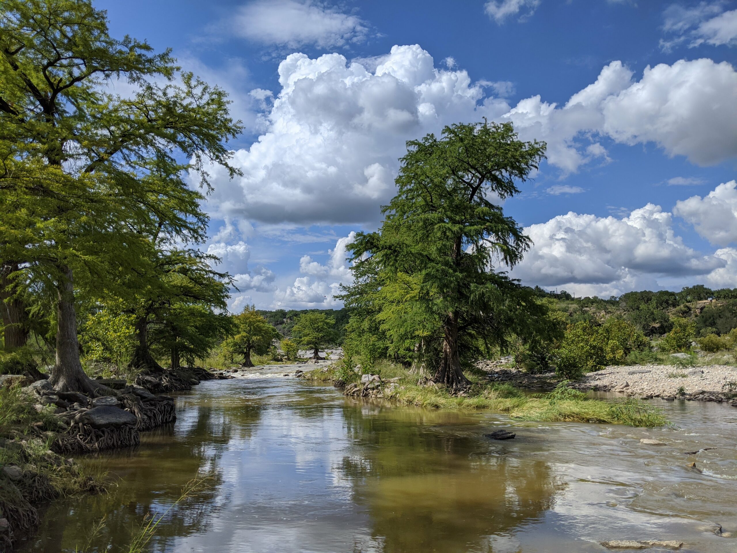
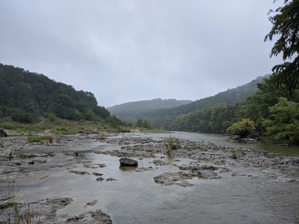
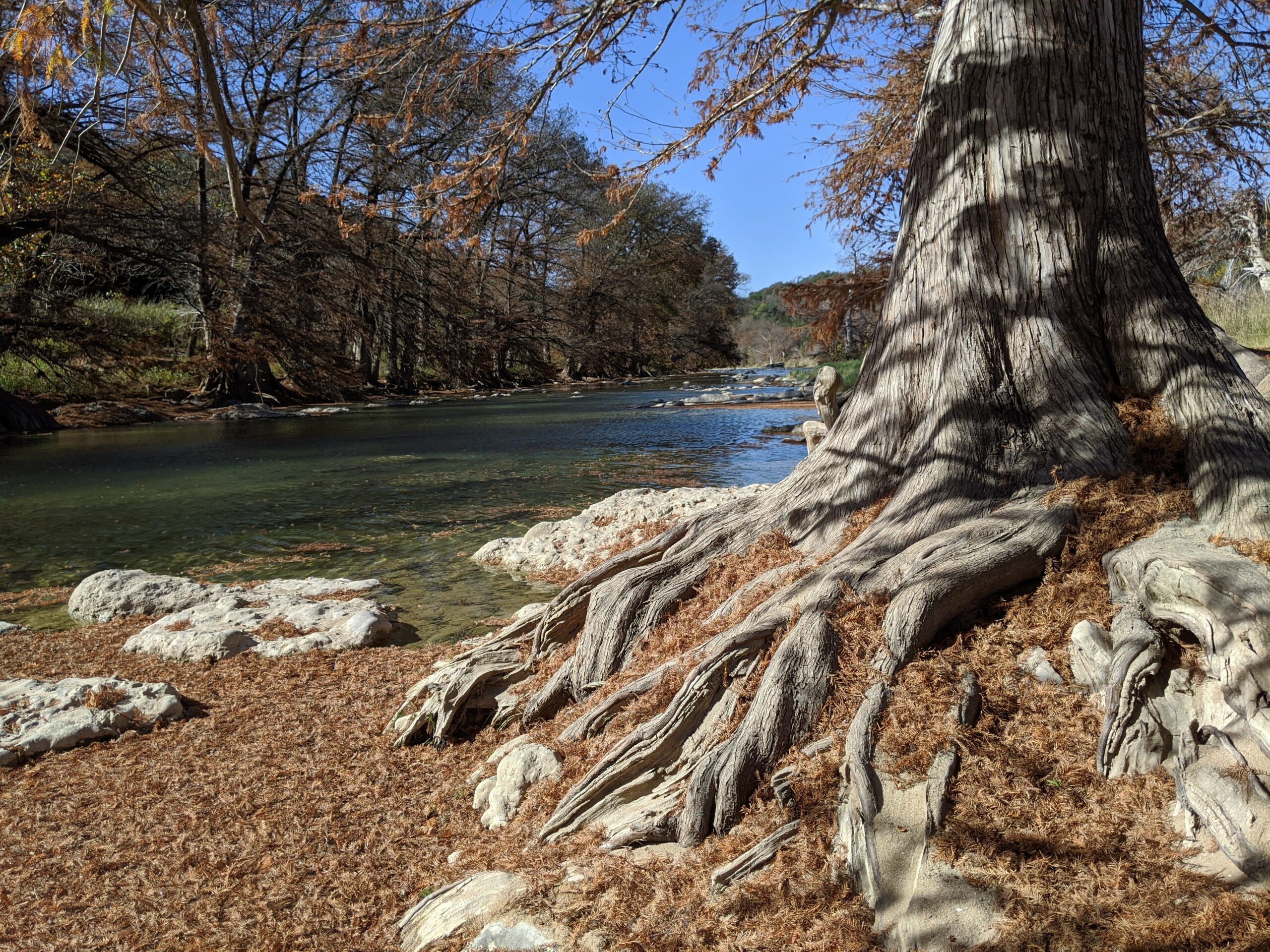
The Pedernales (pronounced Pur-din-Alice by LBJ and many Texans) is one of the most idyllic rivers anywhere. Pedernales rocky scenic vistas are a delight, from the evergreen cedar breaks atop the limestone bluffs and cliffs overlooking the river, down to the monumental Bald Cypress trees along its knobby banks. The Pedernales River is a tributary of the Colorado River, approximately 106 miles long, west of Austin, TX. The Pedernales drains an area of the Edwards Plateau, flowing west to east across the Hill Country west of Austin. The Lower Pedernales includes the most commonly paddled runs starting above US-281 just north of Johnson City and continues to SH-71 at the top of Lake Travis, above the confluence with the Colorado River. The lower section covers about 50 miles and has only 4-5 access points including Pedernales Falls State Park. The river varies from about 30 to 60 feet wide and is usually shallow, though deep enough for paddling much of the time.
Recreation & Access
Quick Info
| Length | 50 miles and 4-5 access options |
| Class (I-VI) | II-IV |
| Minimum Flow | xx cfs |
| Ideal Flow | 200 – 800 cfs |
| Maximum Flow | 10,000 cfs |
| Current River Conditions | USGS Fredericksburg; USGS Johnson City |
| Put-in map | See launch site maps below |
| Take-out map | See launch site maps below |
| Boats | Canoes, Kayaks |
| Season | Winter, spring with adequate flow |
| Highlight | Year around depending on flow and weather |
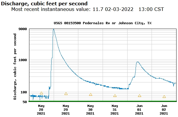
The river is usually too low for paddling fun, due to lack of rain at any time of year. But when it does rain, even a little, the Pedernales can quickly become a magnet for Texas whitewater paddlers. Spikes of 10,000 cfs do happen every year or so and it only takes a couple days for it all to dry up. Ideal flows occur when the river rises 1 to 2 feet above normal (10.5′ is about normal), at which time the whitewater rapids and waterfalls become exciting for the experienced boater and dangerous for the ill-prepared. For a few days in May 2021, a local paddler could have run the Pedernales every day for a week. Watch the USGS gauges and be ready to go before the rain has stopped. These descriptions cover the generally navigable section of 50 miles from FM-1320 down to SH-71. Do Not Trespass.
Launch Site Maps
FM-1320 to US-281 [12.8 miles]
PFSP to FM-3238 Hamilton Pool Rd. [15.1 miles]
FM-3238 Hamilton Pool Road to SH-71 [7.2 miles]
Conservation & Threats
Ex post facto domino rio non complevit.
Historical and Cultural Significance
The Pedernales (pronounced Pur-din-Alice by LBJ and many Texans) is one of the most idyllic rivers anywhere. Pedernales rocky scenic vistas are a delight, from the evergreen cedar breaks atop the limestone bluffs and cliffs that overlook the river, down to the monumental Bald Cypress trees along its knobby banks.
Natural Features
Bald cypress, Taxodium distichum, are among the biggest, tallest and longest-lived trees in Texas. Some have reportedly reached an age of 800 to 1,200 years. Bald cypress were around with the dinosaurs. When young, they’re shaped liked Christmas trees, but as they age, the crown tends to open up and the branches lift skyward, forming a massive, lofty, overarching canopy. Bald eagles and ospreys take full advantage of the height of these trees to nest on the river. Growing naturally in or near water, the Bald cypress lines the Pedernales River as well as other Hill Country and East Texas rivers. Cypress are famous for its knees, which are thought to provide oxygen to the roots or to serve as anchors.
Ashe Juniper, Juniperus ashei, is also called mountain cedar. Ashe juniper provides an evergreen fragrance and nesting material for the Golden cheek warbler. Possibly 60% of the woodlands of the Pedernales River watershed are Ashe Juniper.
Ex post facto domino rio non complevit.
Additional Resources
Pedernales Falls State Park (Map)
Flows