Overview
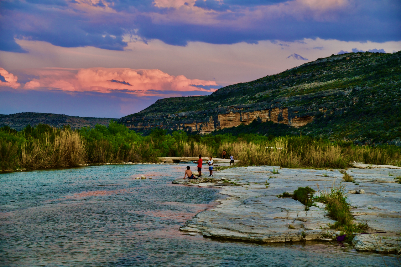
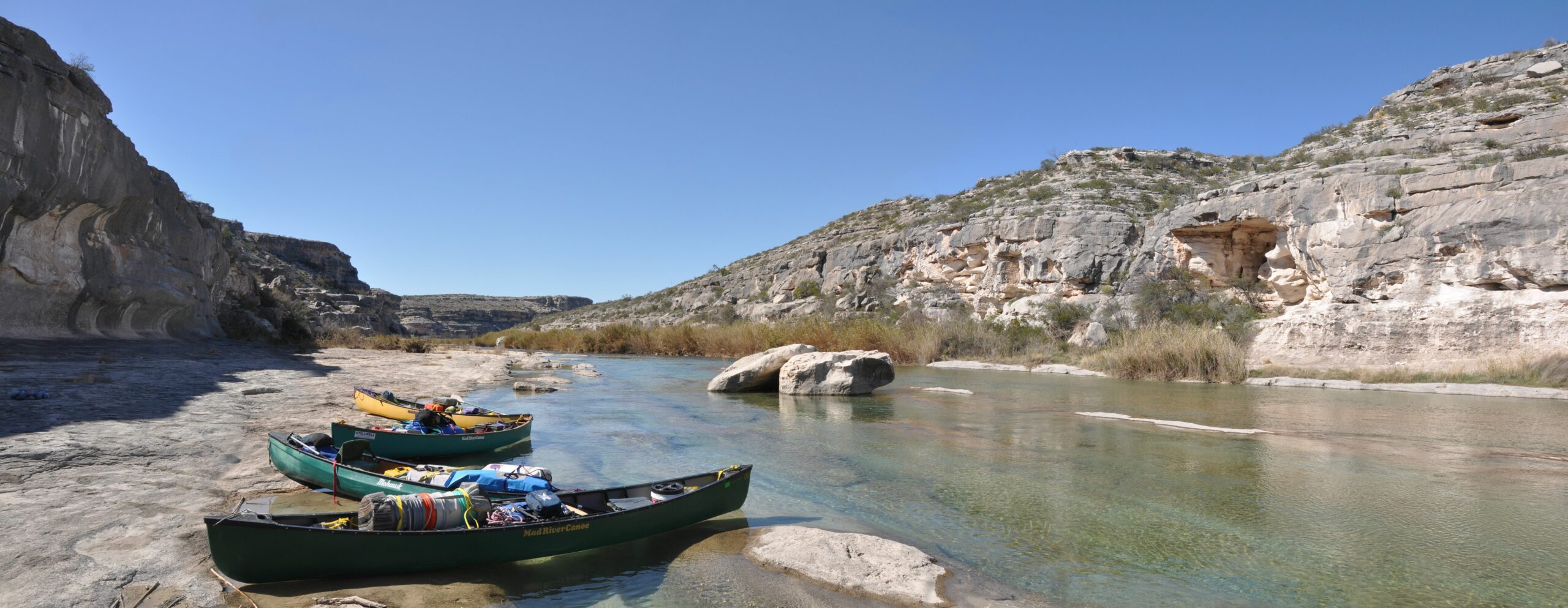
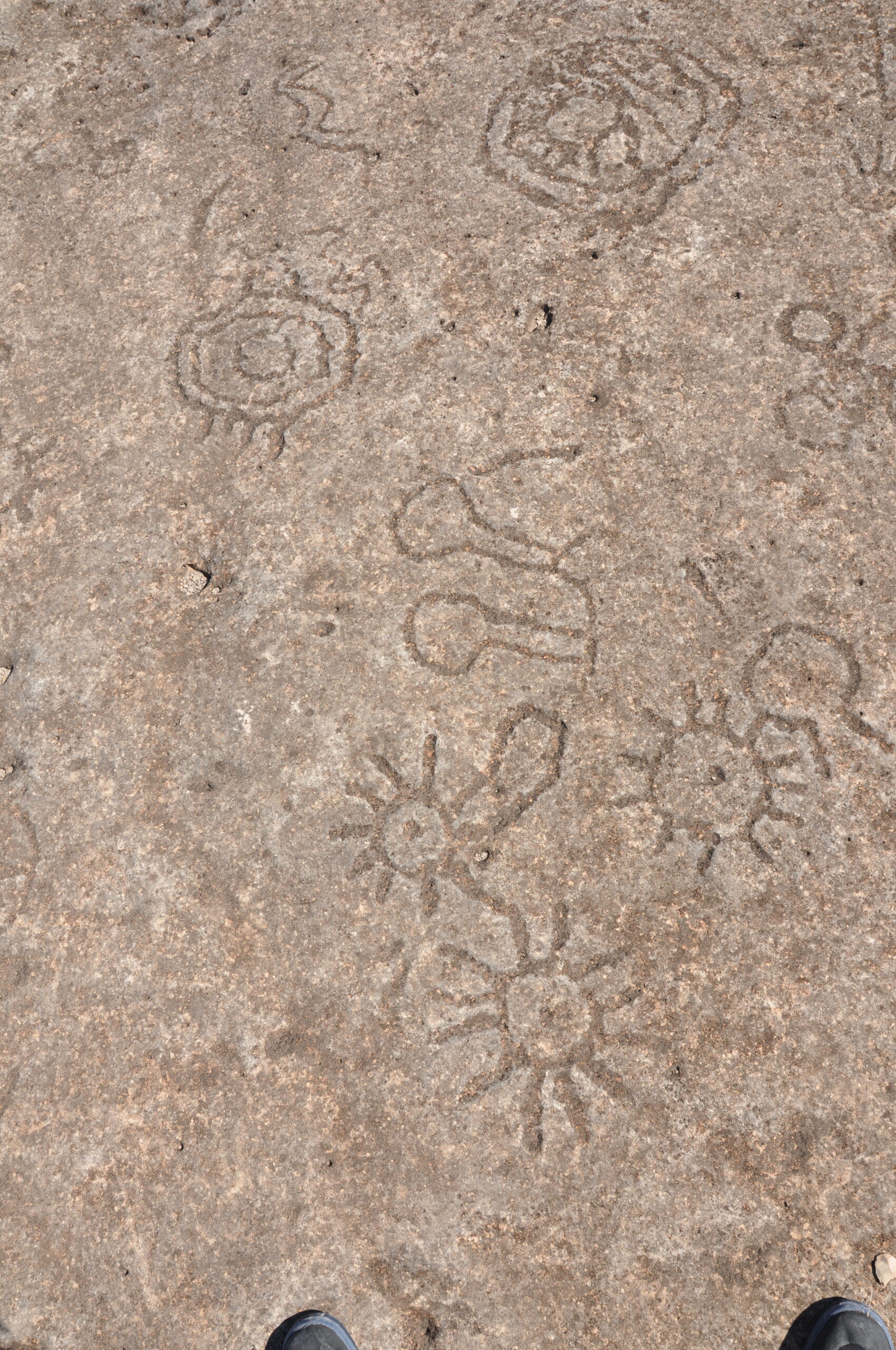
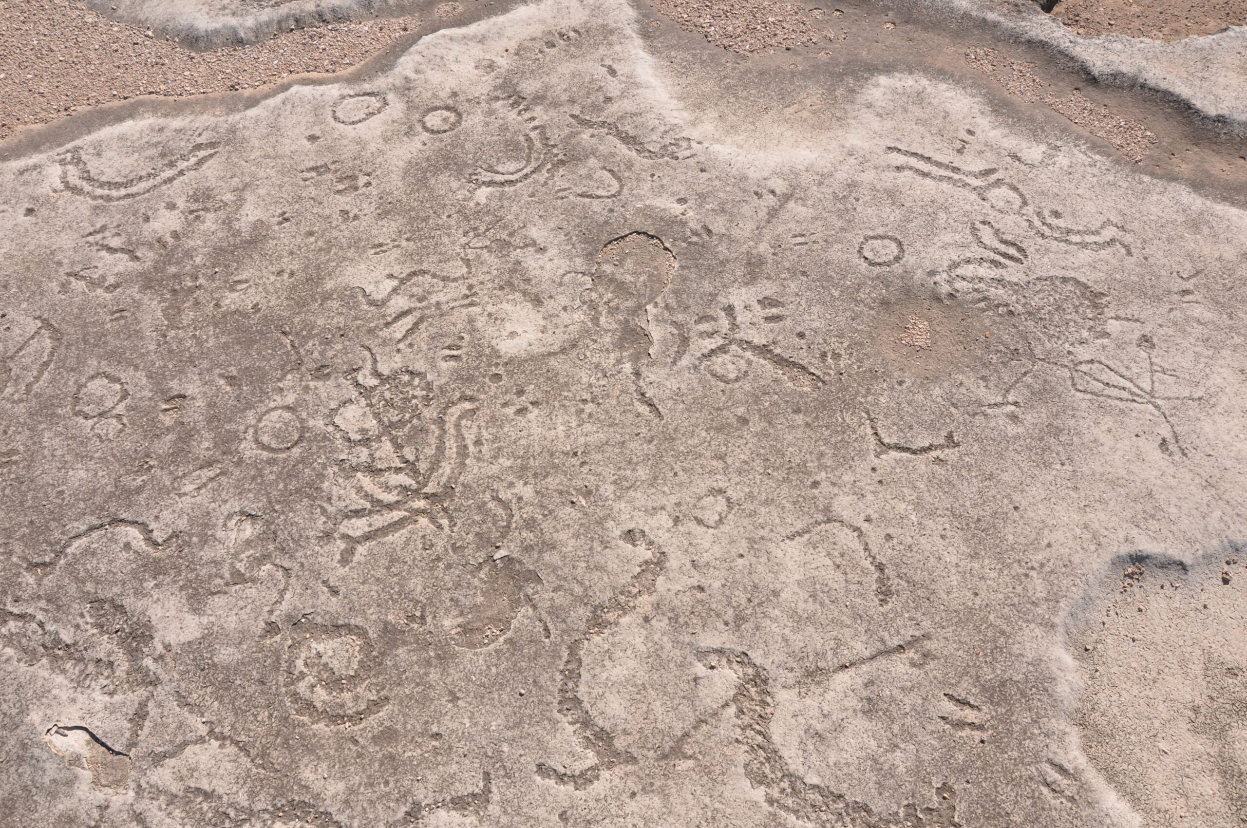
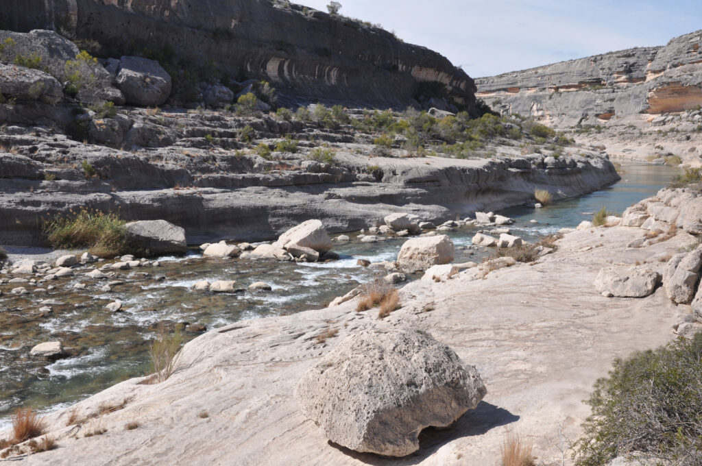
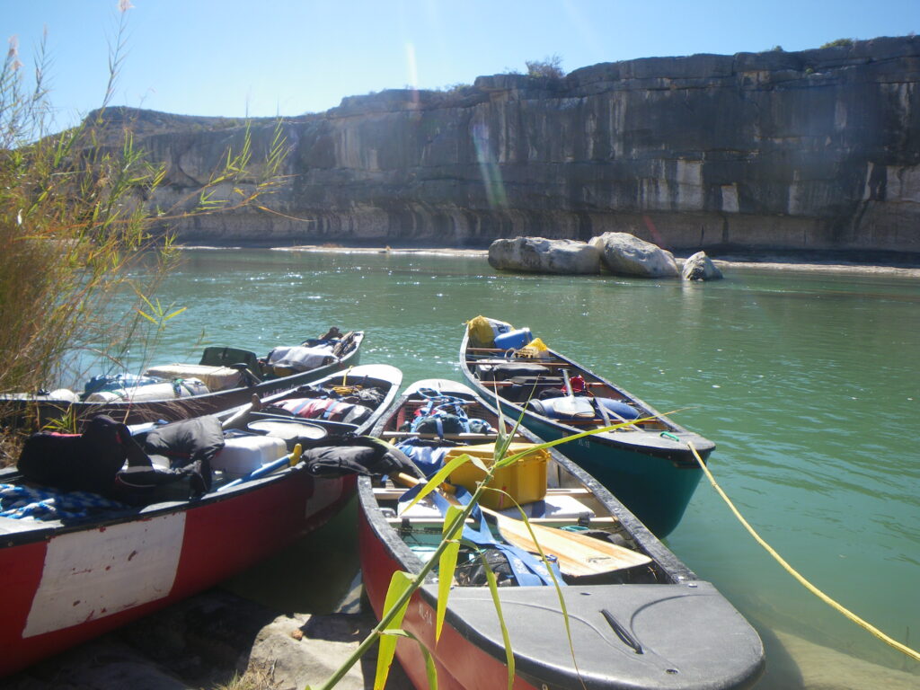
This river has it all – Challenging whitewater, wilderness experience, pictographs, petroglyphs, beautiful canyons and camps. The standard Lower Pecos paddling trip starts at Pandale Crossing and ends with a tow out at Lake Amistad 50 miles downstream. It is a classic pool and drop stream. If you can paddle through another ten miles of headwinds on the lake, the trip from Pandale will be 50 miles at Pass Through Cave (tow out) or 59 miles at the US-90 High Bridge near White Shaman Preserve. If you are able, spend at least 7 days on the river and side canyons. There is much to explore. There are springs on the river but try not to rely too heavily on them as some may be difficult to find. Bring plenty of fresh water or a gravity filter system. The Lower Pecos River, guide by Louis Aulbach & Jack Richardson is necessary if it is your first run on the Lower Pecos. Do Not Trespass. Leave No Trace
Recreation & Access
Quick Info
| Length | 50 miles lake tow-out or 59 miles to US-90 |
| Class (I-VI) | II-IV |
| Minimum Flow | 125 cfs (3.5 cms) |
| Ideal Flow | 200 – 800 cfs (5.6-22.5 cms) |
| Maximum Flow | 2,000 cfs (57 cms) |
| Current River Conditions | Pandale: USGS Water Data; IBWC Gauges (CMS x 35.3 =CFS) |
| Put-in map | Pandale Crossing |
| Take-out map | Pass Through Cave (Lake Amistad tow out); US 90 High Bridge Boat Ramp |
| Boats | Canoes, Kayaks |
| Season | Winter, spring with adequate flow |
| Highlight | Scenic canyons, rock art, whitewater |
| Distances to Pandale, TX | Dallas 390 miles; Houston 450 miles; Austin 300 miles; El Paso 400 miles |
Conservation & Threats
Over-pumping groundwater, Land fragmentation, Bed and bank disturbances, Proliferation of non-native, invasive species, Algae blooms, Cultural vandalism, archeological looting. Oil & gas-sourced pollution. Bacterial infections are easy to contract. Use soap and clean water, especially with open sores on hands or feet. Development encroachment, water pollution.
Historical and Cultural Significance
… downstream, though, are still the Pecos canyonlands in their harsh magnificence, resisting change and civilized human use as they have always done. Lake Amistad has flooded the lowest sections and the river itself has been much diminished in flow, but the carved, rocky, dry, thorny, beautiful land is much as it was when the Pecos People scrabbled out a living there and painted their dreams, if dreams they were, on the walls of their caves. John Graves, Texas Rivers 2002.
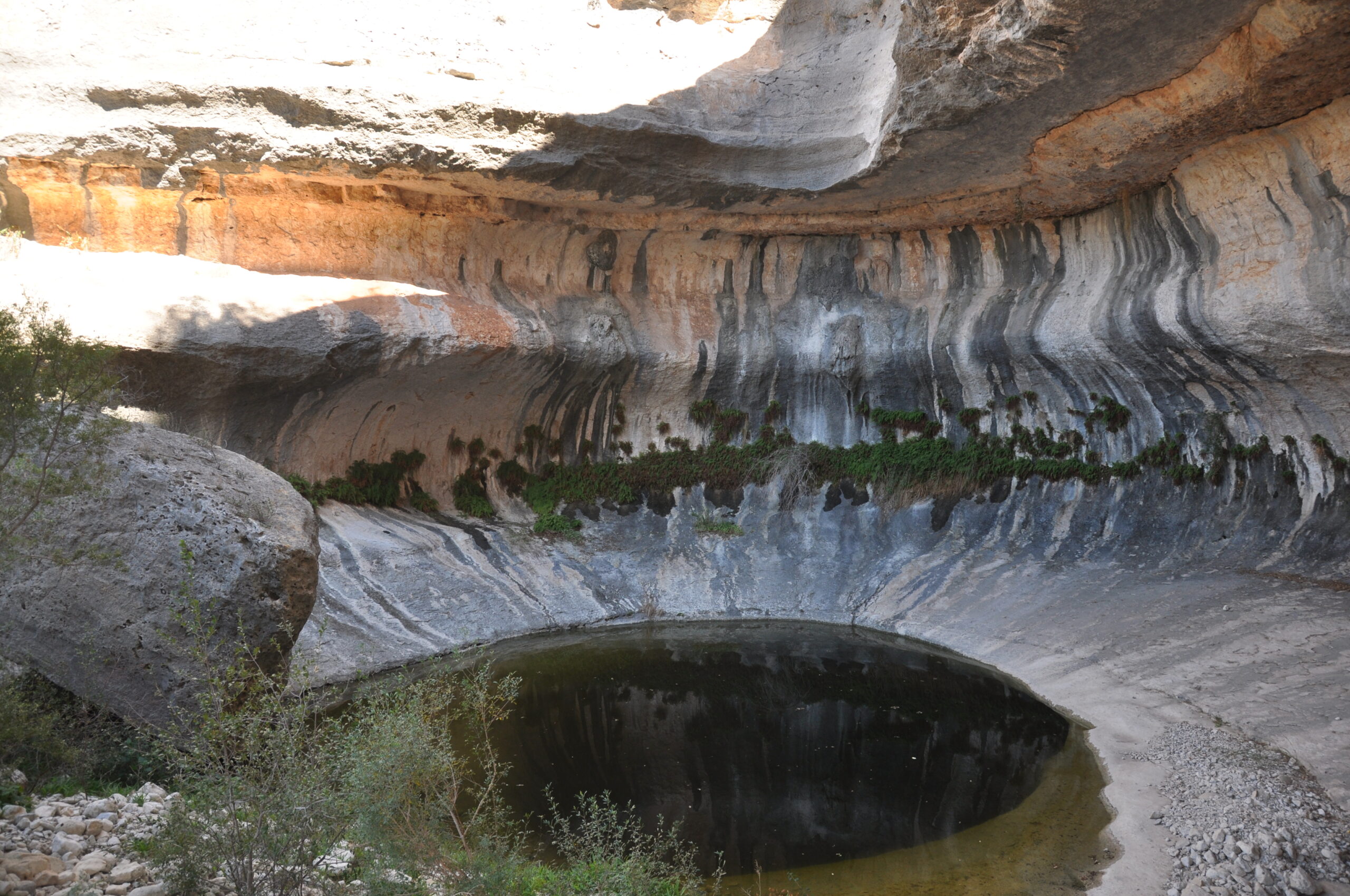
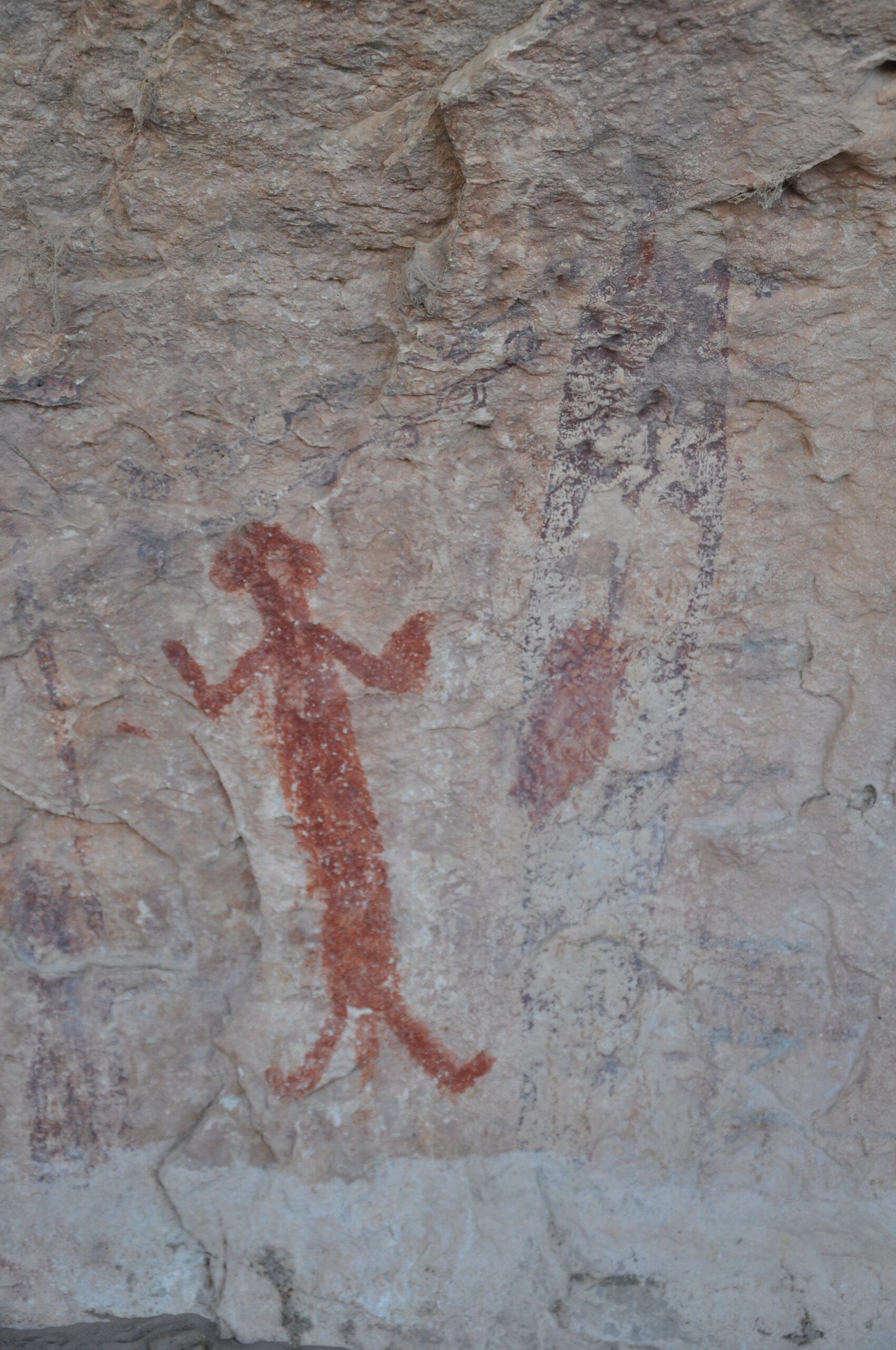
The Lower Pecos has a profound number of petroglyphs at Lewis Canyon. Some of the finest rock art examples are found throughout the trip at many of the side canyons. Sometimes the sites are difficult to locate. At Painted Canyon M44, there are class III-IV rapids, excellent side hikes to pictographs and a great layover camp. Do Not Trespass. You will likely pass through Langtry on a Pecos trip. If you want a little wild west history, stop and visit Judge Roy Bean, Law West of the Pecos.
Natural Features
The clear water of the Pecos belies itself. It is very alkaline and not very tasty. Both natural and anthropogenic salts are added to the river in its course from New Mexico through West Texas. As a result, water entering Texas contains about 6,000 mg/L of minerals and salts. At Girvin, Texas, salt concentrations increased to as high as 25,000 mg/L in July of 2014. There are up to five springs on the river but try not to depend on them too heavily as some are difficult to find. Bring plenty of fresh water.
Additional Resources
- Shumla
- White Shaman Preserve of the Witte Museum
- The Lower Pecos River, guide by Louis Aulbach & Jack Richardson
- Far Flung Adventures, Taos – Guided Pecos Trips
- Video: Kayak Fishing: Surviving the Pecos River – Part 1
- Video: Kayak Fishing: Surviving the Pecos River – Part 4
- Video: Further Exploration of the Pecos & Independence Creek
Flows
- USGS Near Pandale Crossing
- IBWC Near Real Time Reports (PDF) (CMS x 35.3 = CFS)
- TPWD Texas Rivers / Streamflow