Overview
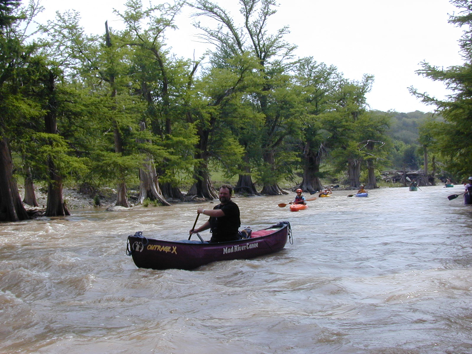
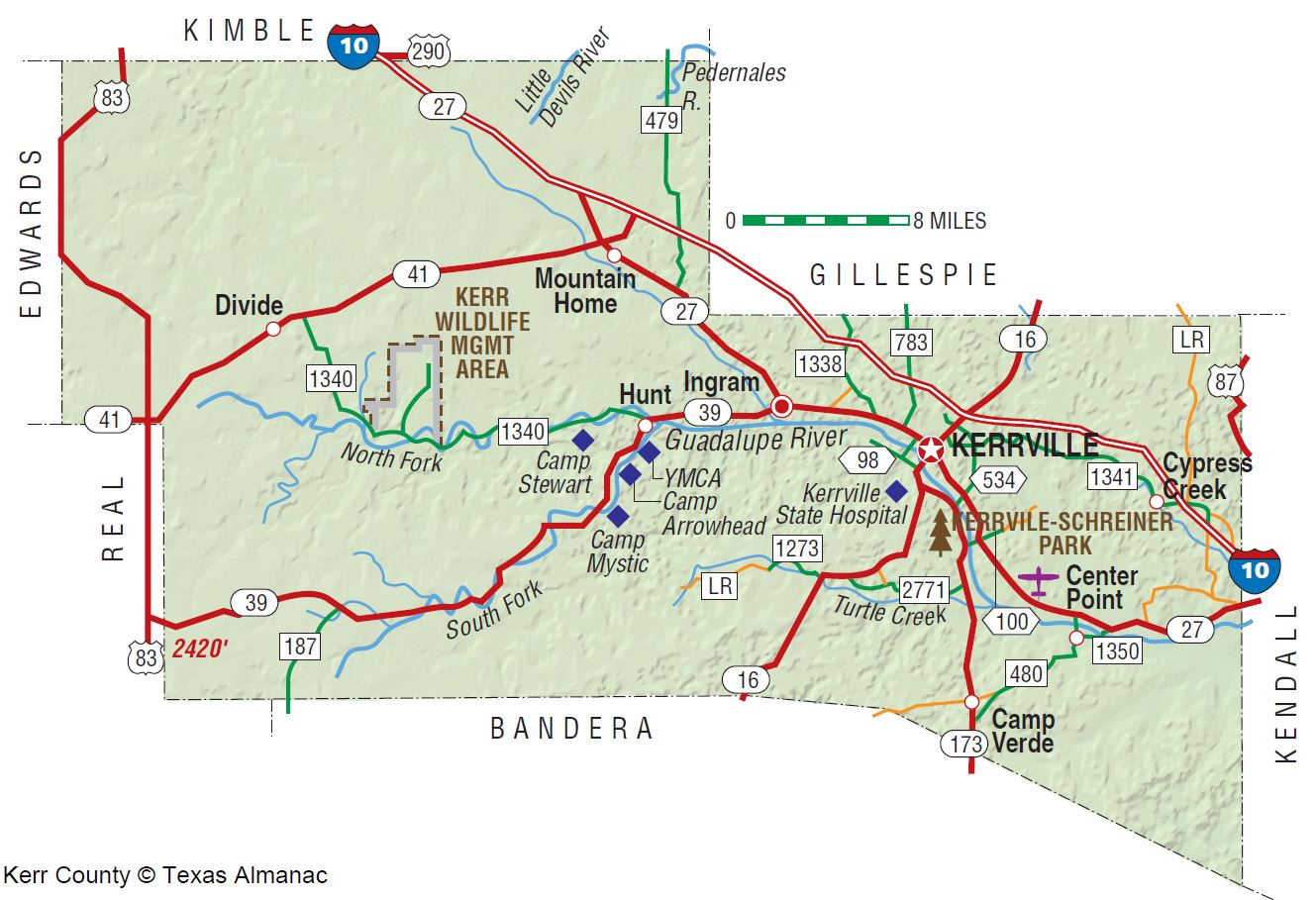
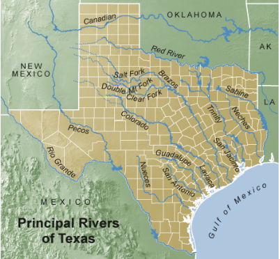
The Guadalupe River is the gem of Texas rivers, offering everything from flatwater to challenging Class III rapids. From Hunt, TX, the Guad’s 420 mile total distance is characterized by steeper gradient in the Upper Guadalupe and generally flat water beyond I-35. The Upper Guad is a spring-fed river that flows from limestone of Edwards Aquifer near Hunt, in Kerr County, down to Canyon Lake Dam, a distance of about 125 miles. This upper section is very rain dependent for flow. Spring rains can bring big water, so know your skill set and research your trip for known portages. Lack of rain can be a problem any time of year and lead to a lot of dragging.
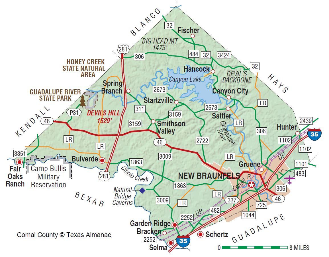
From below Canyon Lake Dam, in Texas’ most popular and overcrowded summertime river recreation area, the Guad’ flows about 28 miles alongside River Road from Canyon through Sattler, Gruene and New Braunfels.
From I-35 to the confluence of the San Marcos is about 95 miles and after another 179 miles the Guadalupe reaches the Gulf of Mexico. Every June the 260 mile Texas Water Safari “World’s Toughest Canoe Race” meets the Guad’ after 81.26 miles of San Marcos River. From there on it’s all Guad’ to Seadrift on San Antonio Bay, all in under 100 hours from the start. Amazing!
Recreation and Access
Upper Guadalupe, Below Canyon Dam and Lower Guadalupe
Quick Info
| Length | Upper: 12 runs of 2-12 miles; Below Canyon: Several of 3-22 miles; |
| Class (I-VI) | I-III+ |
| Minimum Flow | 100 cfs |
| Ideal Flow | 300-1200 cfs |
| Maximum Flow | 5,000 cfs |
| Current River Conditions | USGS: Abv Kerrville; Comfort; Spring Branch; Sattler |
| Put-ins | See featured runs below. Commercial access is usually necessary. |
| Take-outs | See featured runs below. Commercial access is usually necessary. |
| Boats | Canoes, Kayaks, Rafts |
| Season | Year-round, weather/flow permitting |
| Highlight | Fun, cool whitewater. Private property! Do not trespass. |
Featured Runs
Upper Guadalupe River – Descriptions and Paddling Trails
Guadalupe River State Park Paddling Trail [5 miles]
Nichols Landing Paddling Trail [10 miles]
- Upper Guadalupe Launch Site Maps
- Schumacher’s Crossing > Ingram Boat Ramp [4.6 miles]
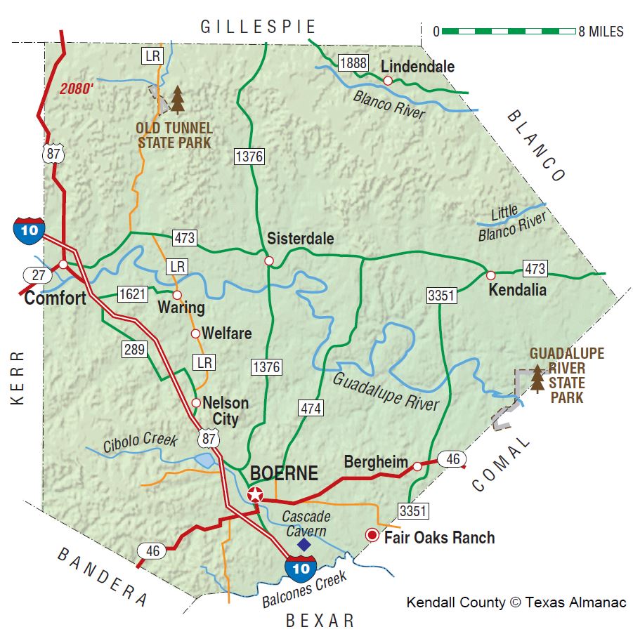
- Lion’s Park Dam Center Point to I-10 Bridge Comfort [12 miles]
- I-10 Bridge Comfort to James Kiehl River Bend Park [6.8 miles]
- James Kiehl River Bend Park to Guadalupe Crossing Waring-Welfare Rd. [4 miles]
- Guadalupe Crossing Waring-Welfare Rd to FR-1376 Sisterdale Rd Bridge [12 miles]
- FR-1376 Sisterdale Rd Bridge to Hwy-474 Bridge [11.3 miles]
- Hwy-474 Bridge to Kreutzberg Canyon [2.3 miles]
- Kreutzberg Canyon to FR3160 Bergheim Campground [12.2 miles]
- FR-3160 Bergheim Campground to Guadalupe River State Park [7.7 miles]
- Spring Branch US-281 to Rebecca Creek Campground [6.2 miles]
- Below Canyon Dam Descriptions
- Guadalupe River Canyon Dam to Gruene [22 miles]
- Guadalupe River Trophy Trout Section – 4th Crossing to 2nd Crossing [7 miles]
- Video: Guadalupe River Cypress Bend Park (+ Comal River) (3.1 miles RT, 215 cfs, TG Canoe & Kayak)
- Lower Guadalupe Paddling Trails
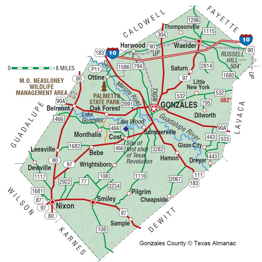
- Come and Take It Paddling Trail (11 miles, Gonzales)
- Independence Paddling Trail (2.6-mile loop, Gonzales)
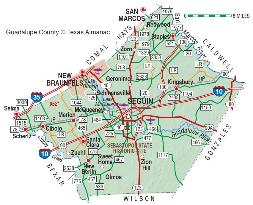
- Seguin Paddling Trail (4 mile loop, Lake Seguin)
- Seguin Paddling Trail (2.6-8.4 miles, Lake Nolte / Meadow Lake)
- Victoria Paddling Trail (25 miles, 4 sections of varying lengths)
Natural Features
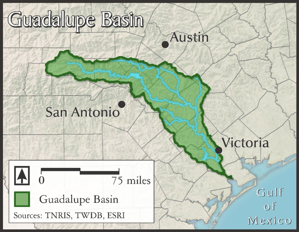
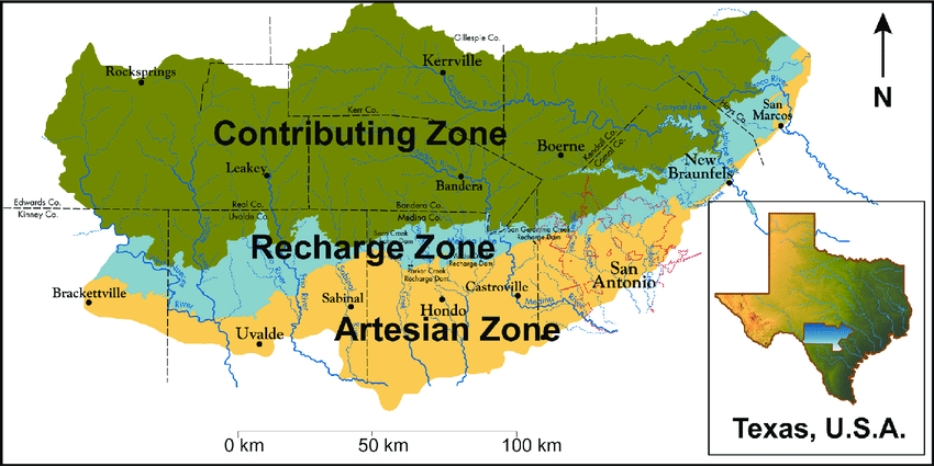
The basic natural feature of the Guadalupe River is the aquifer from which it issues, the Edwards Aquifer. The big springs that contribute to Guadalupe flow – Comal Springs and San Marcos Springs first come to mind. But many small springs come to a critical mass in the Upper Guadalupe watershed to make paddling possible in its upper reaches even during periods without rain. Still, the river is often too low for paddling fun, due to lack of rain and lack of dam release anytime of year.
Bald cypress, Taxodium distichum, are among the biggest, tallest and longest-lived trees in Texas. Some have reportedly reached an age of 800 to 1,200 years. Bald cypress were around with the dinosaurs. When young, they’re shaped liked Christmas trees, but as they age, the crown tends to open up and the branches lift skyward, forming a massive, lofty, overarching canopy. Bald eagles and ospreys take full advantage of the height of these trees to nest on the river. Growing naturally in or near water, the Bald cypress lines the Upper Guadalupe River as well as other Hill Country and East Texas rivers. Cypress are famous for their “knees”, which are thought to provide oxygen to the roots and/or to serve as anchors.
Ashe Juniper, Juniperus ashei, is also called mountain cedar. Ashe juniper provides an evergreen fragrance and nesting material for the Golden cheek warbler. Possibly 60% of the woodlands of the Upper Guadalupe River valley are Ashe Juniper.
Conservation and Threats
Excess algae due to high nutrient run-off. Invasive Zebra mussels. Always wash your boats well between watersheds. Didymosphenia geminata, commonly referred to as “didymo” or “rock snot,” is an invasive freshwater microscopic non-toxic diatom. It thrives in cold, clear, shallow streams.
Historical / Cultural Significance
Gonzales on the Guadalupe (map) is three miles downstream of the confluence with the San Marcos River. On October 2, 1835, rebellious Texians and Mexican soldiers clashed in Gonzales on the Guadalupe River. This skirmish would have greater consequences, as it is considered to be the first battle of Texas’ War of Independence from Mexico. For this reason, the fight at Gonzales is sometimes called “the Lexington of Texas,” referring to the place that saw the first fighting of the American Revolutionary War. In 1831, under Mexican authority, the people of the small town of Gonzales had requested a cannon for use in defense against Indigenous raids, and one was provided for them. In September 1835, following orders from Colonel Domingo Ugartechea a handful of soldiers was sent to Gonzales to retrieve the cannon. Tensions were high in the town, as a Mexican soldier had recently beaten up a citizen of Gonzales. The people of Gonzales refused to return the cannon and also arrested the soldiers sent to retrieve it. The skirmish resulted in one Mexican fatality. The Texians also used the cannon in question during their attack, and flew a makeshift flag reading “Come and Take It.”
Fishing
For kayak fishing on moving water like the Upper Guad, you’ll want a good handling river kayak, like a Jackson Coosa.
- Guadalupe River Angling Records
- Video: Kayak Fishing the Upper Guad at Ingram (TG Canoe & Kayak)
- TPWD North Fork Guad Bio Study 2012
Additional Resources
- Video: Upper Guadalupe Put-ins & Takeouts (TG Canoe & Kayak)
- Video: Kayak Fishing Hunt, TX (TG Canoe & Kayak)
- Video: Upper Guadalupe Spechts Crossing / Nichols Landing to Hwy 281 / Spring Branch
- Video: Kayak Fishing the Upper Guad at Ingram (TG Canoe & Kayak)
- Trip Report: Upper Guad, [46 cfs, I-10 to Kiehl Park] by Saturday Paddlers
- Trip Report: Upper Guad, [200 cfs, Kiehl Park to Boerne] by Saturday Paddlers
- TPWD North Fork Guad Bio Study 2012
- Guadalupe Bass, State Fish of Texas
- Fly-Fishing the Texas Hill Country, by Kevin Hutchison
- TPWD Texas Rivers / Streamflow
- Greater Edwards Aquifer Alliance