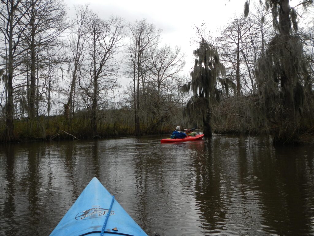
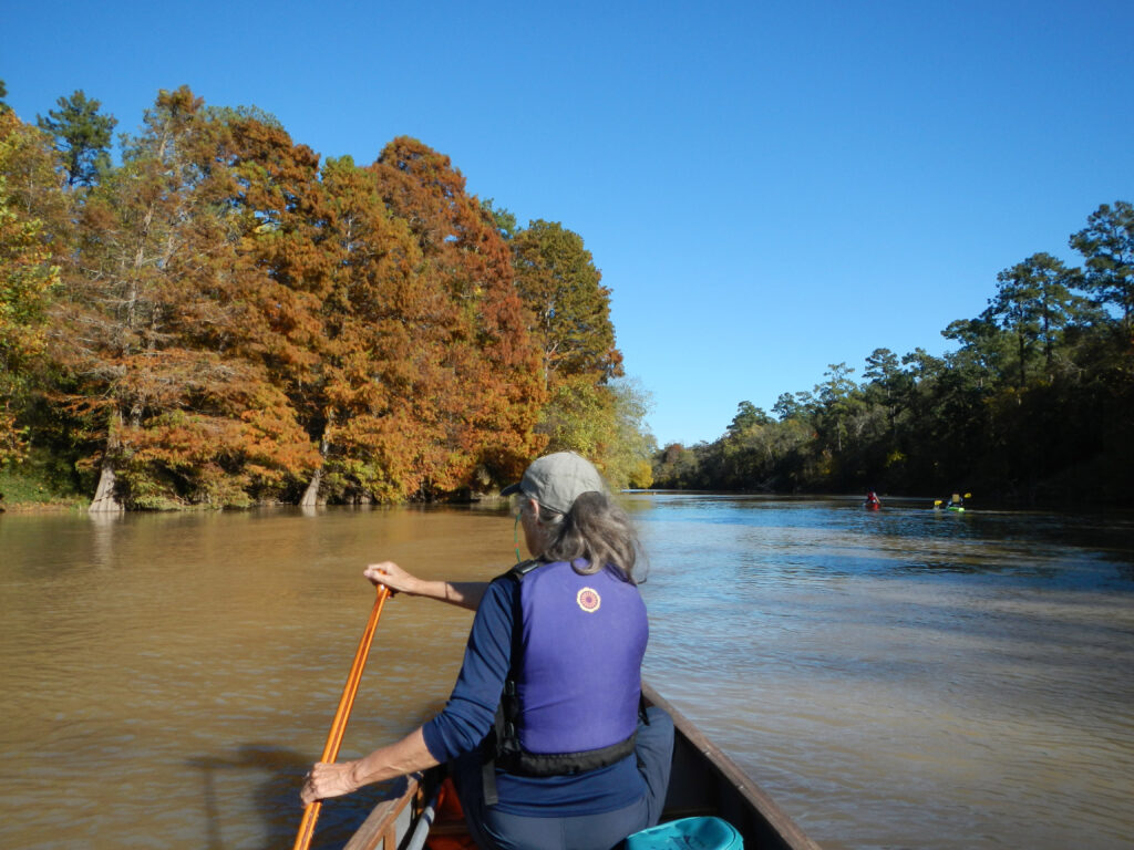
Overview
The West Fork of the San Jacinto River flows through Montgomery and Harris Counties down to Lake Houston, where it joins the East Fork San Jacinto River before emptying into the Gulf of Mexico. Though very scenic, the San Jacinto River may usually be too low to paddle, and even after heavy rainfall the narrow channel and overhanging trees and vegetation make for tough navigation. It is near the Sam Houston National Forest, and has many of the same characteristics of scenic hardwood and pine bottomlands akin to a swamp. The flow is slow and meandering, so plan on adequate time to get downriver.
Recreation & Access
Quick Info
| Length | 37 miles total with 7 runs of 3, 11, 18.5, 7.5, 11.3, 13 and 11.5 miles |
| Class (I-VI) | I |
| Minimum Flow | |
| Ideal Flow | |
| Maximum Flow | |
| Current River Conditions | USGS Humble |
| Put-in map | See launch site maps below |
| Take-out map | See launch site maps below |
| Boats | Canoes, Kayaks |
| Season | Year around |
| Highlight | Very scenic paddling |
The West Fork of the San Jacinto River is navigable anytime water is being released from the Lake Conroe Dam, or immediately after heavy local rainfall. Best conditions usually exist in the spring and fall months, when the area gets most of its rainfall. Beware of flooding conditions during rainy weather, as the low-lying area surrounding the river dumps its excess causing the river to rise quickly. There are no hazards to speak of on the West Fork of the San Jacinto River. Low hanging tree branches and brush, coupled with low water and a narrow channel can make paddling difficult, but not threatening to boats and boaters. A low-water bridge at about 32 miles will require a portage in low water conditions and may be runnable in moderately high water conditions – be sure to scout before attempting to run due to the potential for log jams and strong hydraulic currents immediately below the bridge. Between IH-45 and US-59/69 are 18.5 miles with no take-outs, so plan accordingly.
Feature Runs
Launch Site Maps
- West Fork San Jacinto
- SH-105 bridge to FM-2854 bridge [3.0 miles]
- FM-2854 bridge to IH-45 bridge [11.0 miles]
- IH-45 bridge to SH-242 bridge [18.5 miles]
- SH-242 bridge to Tollway-99 bridge [7.5 miles]
- Tollway-99 bridge to US-59/69 bridge [11.3 miles]
- US-59/69 bridge to Deussen Park Boat Ramp [13 miles down Lake Houston]
- Main Fork San Jacinto
- Below Lake Houston Dam to Baytown Boat Club [11.5 miles]
Conservation & Threats
By Tom Douglas, TRPA Member
Impairments in the lower San Jacinto River and the Houston Ship Channel (Segments 1001, 1005, 1006) include Dioxin in edible tissue and PCBs in edible tissue. https://www.tceq.texas.gov/downloads/water-quality/assessment/integrated-report-2022/2022-imp-index.pdf
During a 1994 major flood, a gasoline pipeline across the river ruptured, causing the river to catch fire (Video). Later, the scene was otherworldly: tree trunks were covered with mud for several feet above ground, and the tops of the trees were charred by the floating gasoline. https://www.youtube.com/watch?v=OBqRTkYz1gU&t=3s In addition, a river meander was cut off by the high water during that flood. Flow in the lower San Jacinto River is controlled principally by releases from the Lake Houston dam, which is operated by the City of Houston. https://www.houstontx.gov/council/e/lakehoustondam/7.8.2021-Gates-Public-Meeting.pdf
Farther upstream on the San Jacinto River, several Watershed Protection Plans have been prepared for the river and its tributaries. There, fecal contamination, as determined by the presence of elevated concentrations of E. coli bacteria, is a frequent issue.
San Jacinto River East Fork (Segment 1003) https://eastforkpartnership.weebly.com/
San Jacinto River West Fork(Segment 1004) https://westfork.weebly.com/
Lake Conroe (https://waterdata.usgs.gov/monitoring-location/08067600/ )
http://www.sjra.net/wp-content/uploads/2014/12/Lake-Conroe-Watershed-Protection-Plan.pdf
Spring Creek (Segment 1008) http://springcreekpartnership.com/
Cypress Creek (Segment 1009) https://cypresspartnership.weebly.com/
All of these streams are used, at least occasionally, by paddlers. https://thcc.clubexpress.com/content.aspx?page_id=22&club_id=496051&module_id=164295
Historical and Cultural Significance
The Arkikosa were the indigenous tribe that lived on Galveston Bay and the lower Trinity and San Jacinto Rivers in Texas, primarily in the present-day Greater Houston area. They are regarded as a band of the Atakapa Indians, closely related to the Atakapa of Lake Charles, Louisiana.
The Battle of San Jacinto was the concluding military event of the Texas Revolution on April 21, 1836. The San Jacinto Battleground State Historic Site and San Jacinto Monument is located at the confluence of the San Jacinto River with Buffalo Bayou. This area is also known as the Houston Ship Channel.
Natural Features
Jones State Forest is nearby.
Additional Resources