This morning the online Smart Wall Map, which depicts completed, on-going, awarded, and planned Border Security Wall projects from the US Department of Homeland Security, has been updated to “wall off” nearly the entirety of the Big Bend region from the Rio Grande via over 400 miles of wall construction. The entire region – and beyond. There are very few exceptions.
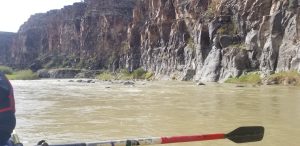
So far beyond, in fact, that the current plan effectively walls off the public from the entirety of the famed Lower Canyons of the Rio Grande, Rio Grande Wild & Scenic River, a currently accessible and protected river corridor managed by the National Park Service. This sacred river corridor is one of, if not THE crown jewel of river recreation in the American Southwest, and is one of the last remaining wild and pristine stretches of river in Texas.
Rivers with Wild and Scenic designation [have remarkable scenic, recreational, geologic, fish and wildlife, historic or other similar values that led Congress to add these waterways to the National Wild and Scenic Rivers System. –US Forest Service website] The designation is supposed to be nation’s strongest form of protection for free-flowing rivers and streams and is intended to protect designated waterways from construction activities and land uses that would alter their flow, landscape, and character.
Goodbye to a river
The newly depicted border wall, for which construction activities have been expedited (thanks to DHS) by waiving every applicable law that would protect the environment and cultural resources, blocks the put-in for floating the 83-mile Wild and Scenic stretch, known as the Heath Canyon put-in, and blocks the take-out at John’s Marina at Dryden Crossing. We are effectively losing our Rio Grande Wild and Scenic River. With the wall built, the designation would be essentially void, as the border wall system would inhibit dark night skies around the river due to lighting and would alter the hydrology of hundreds of tributaries of the Rio due to construction. The entire character and accessibility of the famed Lower Canyons of the Rio Grande are to be damaged and destroyed forever.
Goodbye to Amistad Reservoir and hundreds of private properties
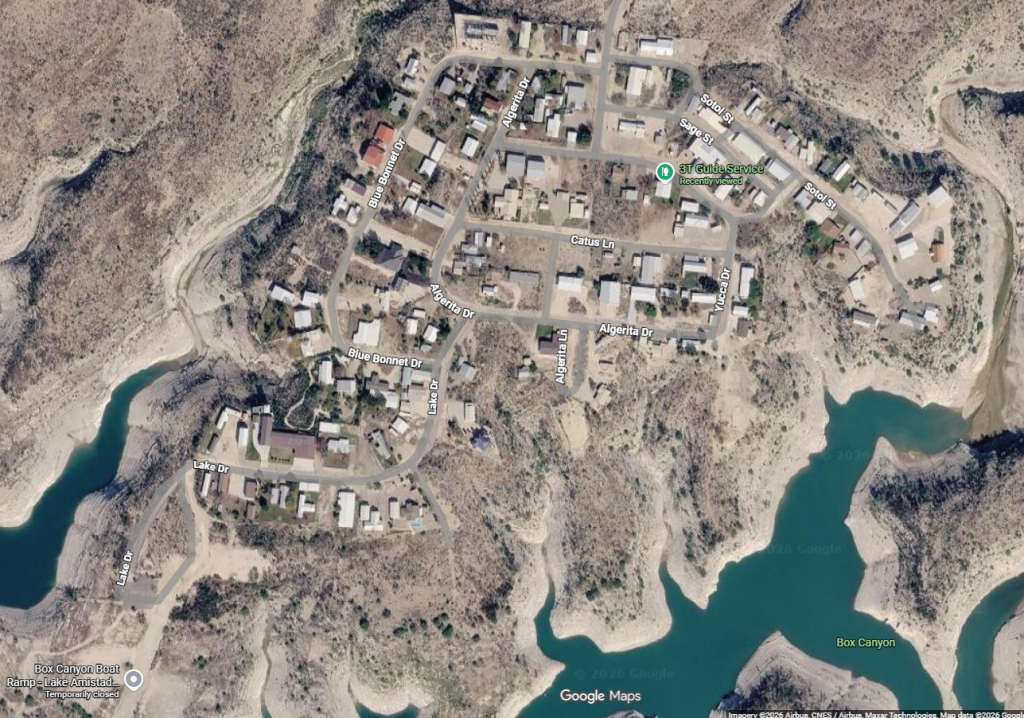
Texans don’t only stand to lose it’s most famed and precious stretch of river to the wall – we also stand to lose lake access to Amistad Reservoir and tens of thousands of acres of the massive Amistad National Recreation Area, where people have enjoyed access to the largest body of water in West Texas for hunting, fishing, and boating since 1965. The lake’s only public boat ramp west of Highway 90, the National Park Service’s Box Canyon boat ramp, is proposed to be behind the wall.
Hundreds of private properties exist in the proposed area between Amistad Reservoir and the border wall – many of them ranches, and nearly 500 of them being lake-front homes at the small communities of Salem Point, Amistad Acres, and Box Canyon. These entire communities would have to be taken from Texans and abandoned forever – all of this in a region which exhibits very little illegal entry numbers and apprehensions compared to the rest of the country’s borderlands.
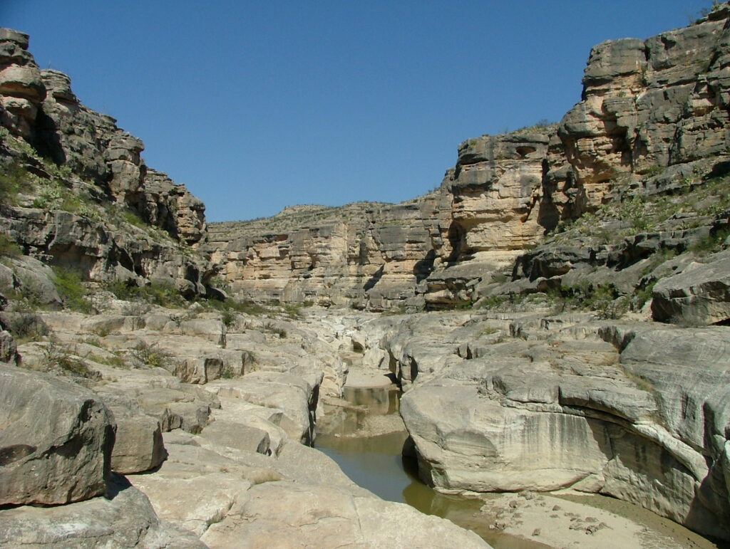
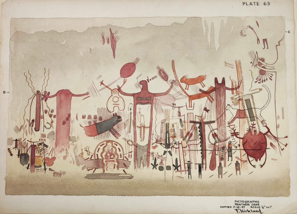
Goodbye to the Lower Pecos’ most famous pictograph site – Panther Cave
Around one hundred acres of the southern end of Seminole Canyon State Park are proposed to be behind this new border wall. In this proposed area lies a national treasure – the famed Panther Cave – a massive rock art (pictograph) site belonging to the Pecos River Style, the predominant Lower Pecos ancient art form, which goes back some 4,000 years. Studies have been done on Panther Cave since the 1930s, with recent studies being performed by the Shumla Archaeological Research & Education Center and Texas State University.
Panther Cave exhibits an enormous, 10-foot-long, red-painted mountain lion, and hundreds of black, red, and saffron-colored human and animal figures, with some human figures displaying animal attributes, such as wings, deer antlers, rabbit ears, or fur. While our little understanding of this ancient, painted polychromatic mural has gradually grown over the years, we still have much to learn from it. The border wall outright threatens the accessibility, continued study of, and preservation of this sacred, prehistoric site.
Goodbye to the Rio Grande
These potential loses of access to our nation’s fourth-longest river are some of the most heinous proposals that ever been made to Texas’ rivers. For us in the paddling and guiding community and those of us in the Big Bend, these proposals affect our livelihoods and the local economy of the Big Bend region. For all Texans, these proposals affect our culture, our natural heritage, our most important sacred sites, our State Park and National Park systems, our wildlife, and our shared river systems that have been cherished by people in this region for thousands of years.
We have been wondering when construction could start – many are saying June of 2026. Word on the dirt roads in Brewster and Presidio Counties are that dozens of contractors have been in the area this month, February of 2026, including RIZZO International of Pittsburgh, Pennsylvania, as they scout the area for location analysis and other pre-construction activities.
It is apparent that DHS and US Customs and Border Protection recently awarded a whopping $1.5 billion dollars to AMI Metals, Inc. of Brentwood, Tennessee, for steel product, conveniently the day before DHS Secretary Kristi Noem signed off on waiving 28 laws to expedite border wall construction in Texas, and that such product is on its way to El Paso.
TRPA has previously created a list of places we stand to lose from the entirety of DHS’ recently proposed Border Security projects. The list has now grown and includes the following:
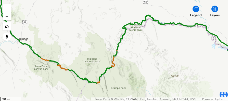
-Total mileage of proposed “Primary Border Wall System” within the Big Bend region: 441.2 miles
-(Seminole Canyon State Park) Panther Canyon Pictograph Site, Panther Cave Overlook, Rio Grande View, Rio Grande Trail, Canyon Rim Trail;
-(Amistad National Recreation Area) tens of thousands of acres of public hunting and fishing federal land, west of Highway 90; Pecos Day Use Area, Pecos River Comfort Station, Pecos River Boat Launch, Box Canyon Boat Launch; communities of Box Canyon, Amistad Acres, and Salem Point;
-(Rio Grande Wild and Scenic River) losing entire riverway – loss of Heath Canyon put-in and John’s Marina (Dryden Crossing) take-out; loss of Wild and Scenic Status;
-(Black Gap Wildlife Management Area) all river access and fish camps;
-(Big Bend National Park) Santa Elena Canyon and River Access, archeological sites, the Dorgan Sublett Trail, parts of the Ross Maxwell Scenic Drive, Cottonwood Campground, parts of River Road West, Buenos Aires campground, Black Dike campground, the Gauging Station, Loop Camp, Jewel Camp, Woodsons Camp, Talley 3 & 4, Solis Landing and Campgrounds, Rooney’s Place, San Vicente Crossing Road, La Clocha campground, the Hotsprings and Hotsprings Trail, Ernst Ridge Trail, Daniels Ranch, Rio Grande Village, Boquillas Crossing, Boquillas Canyon Overlook;
-(Lajitas) the Lajitas boat launch, parts of the Lajitas Golf Resort;
– and (Big Bend Ranch State Park) West Entrance Picnic Area, archeological sites, the Hoodoos Trail, Arenosa Campground and boat ramp, Colorado Canyon boat ramp, Closed Canyon Trail, Grassy Banks Campground and boat ramp, Contrabando Day-use/Movie Set.
We stand together with our friends at No Big Bend Border Wall, the Land Justice Community School, Far Flung Outdoor Center, Angell Expeditions, Big Bend Conservancy, Center for Biological Diversity, Keep Big Bend Wild, National Parks Conservation Association, along with affected landowners in Presidio, Brewster, Hudspeth, Terrell, and Val Verde Counties, and others to collectively organize, act, and say, on behalf of the Big Bend:
¡NO AL MURO!
We encourage following No Big Bend Border Wall and reaching out to them directly to get involved locally; also, please attend a scheduled protest at the state capitol in Austin on April 4th, 2026, at 4pm, organized by our grass-roots partner Save Big Bend.
Join us in signing the petition here.
Join us in writing to your representatives.
Join us in calling your representative daily.